Thursday, November 12, 2015

Arkansas with Leslie & Shirley

Highway 9 in North Central Arkansas

Returning to North Central Arkansas, we planned to leave early enough to stop in at Grand Gulf State Park and Mammoth Springs State Park along the way. The early departure was easy enough, but it was around 11 am by the time we reached Springfield. It was a cold and windy day, and it would likely be 2 pm before we reached those stops. That really did not leave much time for the parks, as well as reach our final destination before dark, which was another 2 hours from there. It was deer season after all, and those pesky critters would be lurking along the roadside looking to pounce on any unsuspecting traveler. Since there was no hurry on the way home, and the forecast for our return trip looked to be a bit sunnier and warmer, we decided to postpone that diversion until then.

Bonniebrooke signage

We did make a few random stops along the way though. Nearly every trip south we note a faded billboard near Walnut Shade pointing the way to the “Home of the Kewpies,” and wonder about it. With nothing but time on our hands this particular Saturday afternoon, we decided to make a detour and check into the situation. Our timing could not have been better. After winding our way up the hill and into the empty parking lot, we discovered the place was closed for the season.

Mural in Historic Leslie, Arkansas

Seeking another minor diversion along the route, we stopped in on the little town Leslie. This is another spot we have noted a couple of times, based on signage indicating indicate that “Historic Downtown Leslie” is quite a happening spot. Set back from the main road a few hundred yards, it is mostly a collection of buildings from around the turn the 19th century housing little or nothing but antique shops. That seems to be pretty typcial for a lot of small towns these days. There seems to be signs everywhere to visit one historic downtown or another, and they all seem to end up lacking any sort of recognizable history. There were a few interesting architectural items here though, but clouds deterred any true photographic exploration of the scene, so we hit the road again, to make our destination prior to sunset.


The Little Red River near Heber Springs, Arkansas

This particular visit to Heber Springs did not offer much opportunity to explore. While it was a 5-day adventure, two of those were devoted to driving and one to getting a little work done. We did manage to squeeze in day trip back to Gunner Pool for a closer look around, and making our way back to base that same day, dropped in on the Turkey Creek Schoolhouse. I had discovered it was listed on the National Register of Historic Places while doing a bit of research earlier in the month, along with a several other points of interest, providing me quite a catalog of spots to investigate in the future. There was one other on that route too, but we must have missed it.

River Road near Shirley, Arkansas

Along the route, there were a few other oddities, as well. Eventually we ended up in Shirley, so dropped in on the old Missouri & North Arkansas railroad bridge that crosses the Little Red River. We crossed the old rickety thing and followed the road for about 10 miles or so, just to see what we could see. The old rail bed offered nothing more than a flat gravel road though, but that was good enough at the time. The only other day we had, we spent at the shooting range.

Woods Fork

Waiting to visit the two State Parks on the return trip turned out to be a poor decision. Thunderstorms rolling through the area put a stop to those plans. Indeed, severe weather was everywhere the day we returned. It did break momentarily, just about the time we were passing through the Branson area, so we stopped at one the last places available on the route to get out and get some air and enjoy the forest. A couple of riders on horseback provided some comedy relief there, but inevitably, the rain returned and chased us from there too.


. . . 

Further Reading

A neatly preserved piece of Arkansas educational history

A beautiful little space for a Confederate storage depot

A quick and quiet spot along the US-65 route

Wednesday, November 11, 2015

Busiek at Woods Fork

Walking Bridge crossing Woods Fork

Tucked just off US-65 between Branson and Springfield, is a great little spot to get out and walk around for a minute, if you need a break from the road. There is actually quite a bit more to do there than that, but we only have ever had time for that. Looking a little closer on our last visit, we should probably plan to make some time for the space in the near future.

Woods Fork

Named in honor of locals, Dr. Urban and Marie Busiek, and originally purchased from their son in 1981, the 2,502-acre Conversation Area hosts a fantastic forest full of woodlands, glades, and old farm fields. Camp Creek and Woods Fork cut through this section of land that provides 18 miles of trails for hikers and horseback riders. Primitive camping is also available by permit only, and a shooting range is also available. While the streams are insufficient for fishing anything more than minnows and tadpoles, hunting is available for all game in season.

Horses crossing Woods Fork

This last pass through, we wandered a little along the trail along Woods Fork, and explored the creek bed near the bridge mostly. It had been raining all day, and threatened more, so we did not want to get too involved. Indeed, it started up again, forcing a return to the dry safety of our car. While we were there though, we had the opportunity to see a couple passing through on horseback. It was amusing watching them try to keep control of the younger of the two, as the horse was more interested in playing in the water. After they passed through the creek bed, the horse turned back, in spite of protests by the rider, and began to splash about. The rider finally convinced the horse to return to the trail, but not before pressing the issue one last time.

Missouri Department of Conversation Map of Busiek State Forest and Wildlife Area - Nov 2015

...

Further Reading

Sunday, November 1, 2015

Parade Directions Fail

As a cartographer and geographer, nothing is more irritating than bad directions. They confuse people and create unnecessary chaos. The problem is compounded when these directions come from a “Trusted News Source.” I suppose the only thing that could be more annoying would be someone attempting to justify, or argue in favor of the bad directions.


After the Kansas City Royals won the World Series, a parade was in order to celebrate the momentous occasion. Everyone wanted to be The New Source for the parade information online, and everyone seemed to get it right, except for KMBC; not only did they get it wrong, but when several of us notified them of the inaccurate directions, they refused to correct it. Additionally, there were those on their comment forum attempting to argue the accuracy of the directions originally provided by KMBC as well. I am still not quite sure what to think of that. One individual asked, “What does it matter?” It matters a lot to those that are not from Kansas City, or know nothing about the layout of the downtown streets. Providing good advice is better than arguing though, so I suggested they take a look at a map.

See if you can follow the directions, as posted on the KMBC web site.

Here’s the starting point… 39.097790, -94.581003

The parade will start at Noon on Grand Boulevard between the Sprint Center and Power & Light District.
From there it will head north on 9th Street before turning east on Oak, south to Truman, then west back to Grand.
The parade will then head south on Grand to Pershing Road and head west.
The parade will end in front of Union Station where a victory rally will begin at approximately 2 p.m.
If you are not familiar with Kansas City, or are admittedly directionally challenged, here are a few notes about what went wrong.

You cannot travel North on 9th Street from the Sprint Center. It is five blocks away! Is the parade going to teleport there?
You cannot turn East on Oak. That street runs North/South; that is, unless they are only crossing the street, then by all means, go right ahead. Although, you are going to have some trouble getting to Truman Road, turning East on Oak.

Thursday, October 8, 2015

A Silver Focus


And so begins the saga of the 2015 Ford Focus SE, replacing the Escape. I had been mulling over trading down anyway, as the latter was a bit more than I really needed, was not very good on gas mileage, and of course, the previously documented issues. The dealer and the discounts made it an attractive deal that really did not cost either of us. They will likely flip it for more than they gave me for it, but I came out on top too.

We tend to drive some rather great distances at times, and the gas mileage will definitely be worth it just for the daily commute alone. That was primary purpose anyway. With everything that comes standard, there was not much more that I really needed. The only option it has is Cold Weather Package. I did not even really need that. I could have bought a white model that had nothing, but thought my hands and my bottom might enjoy this feature during winter. I also decided to go with a manual transmission; partly because small cars are better that way, and partly because of the multitude of horror stories that I had read about the automatic. The dealer even suggested we would probably not be happy with an automatic.


2015 Ford Focus SE sticker A lot of thought went into deciding to just stay with Ford, and the model itself. I considered a used Impreza or Jetta initially, but the thought of a used car without a warranty was not convincing enough. It was going to cost the same in the long run; perhaps less in the really long term. Time will tell. That is what this post is all about; documenting the life of this vehicle.

After resolving to stay with Ford, I tried out a Fiesta, which is a a fun little car. I needed just a bit more space than that though, and it was like riding in a personal rocket ship. That never ends well for me. I also tested out the 3-cylindar Focus 1.0L with Ecoboost. It was just about a gutless machine. There is a night and day difference between it and the 2.0L and I really was not fond of the idea of the 1.0 turning itself off when it felt appropriate to do so. I still want a little bit more control of that.

A silver 2015 Ford Focus SE with 2.0L I4 GDI Engine and 5-Speed manual transmission was my final choice, it is a nice little ride. It is ergonomic to an extreme. One friend told me the drivers seat was like being in a little personal submarine. Everything is at your fingertips and seemingly in the perfect place, even for someone at our height of 6 ft.


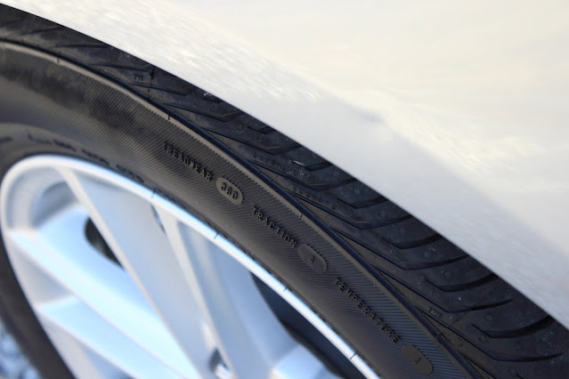
There was only one defect that nobody noticed until we went to pick it up. There was a dent above the driver side front wheel. The dealer said he could have it fixed easy enough. We scheduled a time to go in on Thursday and it only took 15 minutes. The dent remover was a little concerned it might break the paint at first, but with assurances from the dealer that they would fix that too, he went ahead and it all worked out. I still took a photo of it, just in case the paint fails there in the future.

After driving it for a week, there only are few things of note at this time. It sounds kind of funny when it starts, growls a little, but quickly smooths out. The hill-assist is going to take some getting used to. It acts like a break, when taking off from a stop on a hill. Taking off on freshly wet city streets was a little slippery one day, and I heard the traction control doing its thing. The only thing I really hate, that I can do nothing about, is the method for raising and lowering the seat. The last car was the same, so I guess I can put up with it, but how did that get through design? Surely,something more air pressure or hydraulic could have been devised. I have a hydraulic floor jack in the garage that works better than that hand crank system.

It is a good car though, and well worth it. Averaging about 30 mpg thus far, and looking forward to taking it out and stretching its legs a bit soon. Still need to get the front end bra to protect it on those journeys through the bug fields of south Missouri and Arkansas, as well as a roof rack to transport the kayaks. Looking forward to getting some good use of this vehicle and writing more milestones.

Sunday, September 6, 2015

No Fishing, Just Hiking

The Volunteer Trail towards Steele Falls

Steele Falls to Blanchard Springs by way of Gunner Pool

Our mission for the day was Steele Falls, just north of Mountain View and Blanchard Springs, in the Ozark-St Francis National Forest. Based on what we had already witnessed, it was likely to be dry as well, but we forged ahead anyway. It was only an hour north from our location, and there were other interesting things to investigate if that did not work out.


We were out relatively early and on location by late morning. It had not been difficult to find. We had a book with the coordinates in it, along with fairly specific directions on locating the falls. It was not quite as clearly marked as anticipated, but there were not as many turn offs to choose from on the 5 miles of gravel wash board we traversed to find it; indeed, the one or two choices we encountered were pretty obvious.


The hike down into the hollow was not very difficult either, as the book promised. It was not quite as “pleasant” as the book outlined though; that is, unless you discount the gnats, chiggers, horseflies and mosquitos that pestered us at every opportunity. The best thing one could do was to keep moving and hope for the best. Another obstacle, which my good friend Harley was good enough to let me block, was the spider webs. They were everywhere, and after the short mile-long hike down to the bed of the creek, I felt as though I was crawling with the little monsters.

Blue Morpho Butterflies

We lingered at the junction of the trail and the bed of the creek for a bit, debating whether to pursue the current course of action or not. We hiked in about 20 yards or so. The book indicated that we should follow a Volunteer path that followed the creek, and that seemed easy enough; assuming the bed of the creek was the path. There were downed limbs everywhere though, and more spider webs, worse than during the trip down. The dry creek did not look promising either. After a bit of discussion, we decided to wait for another time later in the fall. We had other options anyway, and began the trek back to the car, pausing long enough to marvel at a cluster of Blue Morphos butterflies that had come all the way up from Peru to observe our struggle.

North Sylamore Creek at Gunner Pool Recreation Area

Winding our way back to the Gunner Pool Road, we decided to drop its namesake. I had always seen the sign, but had never bothered to stop in. What a surprise! A perfect little camping area alongside a shallow and clear creek trickled through. After wearing our shoes down on the hike, we decided it was a good time to kick them off and wade it. The water was cool and refreshing, but the bottom covered with smooth round stones was not quite as comfortable as it appeared; additionally, the safety of the large fallen rocks on the edge was an illusion. My first attempt to secure footing on them proved almost fatal for the camera. Covered with a slick glaze of moss, I slipped and stumbled, then quickly retreated to the sure footing of the not-so-comfortable pebble bed of the creek.

We lingered only a short while before heading over to Blanchard Springs, stopping in at the Visitor Center long enough to find a line for the cave tours stretched out to the doors. We waited for a few minutes and then decided to come back. We could waste a little time at Mirror Lake and let the crowd die off a little. There were people everywhere there too though; at least, on the trail leading to the outpouring from the caverns.

Halfway up the dry falls at Blanchard Springs

Determined to explore less populated opportunities, we started to turn around and noticed the flow of water that comes in from the other side was non-existent. Wandering between the huge boulders, looking for a good shot up the dry falls, I soon found myself halfway up. A few other folks were working their way up, and it looked easy enough, so I decided to forge ahead; behind me, Harley mumbled something about being surprised that I had him climbing a rockslide. There was no sympathy. He had been warned about this. We made it nearly to the top with very little effort, and captured some interesting photos along the way, but stopped when those that had gone before us mentioned a snake lurking nearby. We obtained directions on how best to avoid the legless beast, and quickly passed without incident.

Stone Dam holding back Mirror Lake

The trail back down was the path of choice for a leisurely stroll back to the parking area. It picked up again across the parking lot, and since we had nothing but time on our hands, followed that lead. I warned Harley though; if we followed it, there would likely be more rock climbing involved. He remained undeterred. It turned out that I was mostly wrong, and a relatively easy hike, following the edge of the 3-acre rainbow trout haven, to a stone dam constructed by the Civilian Conservation Corps (CCC) back in the 1930s.

The original lake and dam were not a CCC venture though. One Steve Mitchell and his crew originally constructed a wooden situation sometime during the early 1900s to serve his mill and the surrounding community with ground corn and ginned cotton. The dam failed, the CCC reconstructed it. They planned to restore the old mill to operational condition as well, but World War II put a stop to that.

The Ruins of Mitchell Mill

Continuing through the ruins of the mill, we found there was a path that led down to it from above, and so chased. It seemed there were only two choices when we reached the end; either return the way we came, or walk the road a half mile back to the car. We chose the latter, but noticed another trail below the road along the way.


We returned to the cave after that, only to find out that all of the remaining tours had just sold out. That was a little bit of a bummer. Harley had never been through a cave, and we were looking forward to cooling off in the damp and dark recesses after all hiking around in the hot and humid environment that is North Central Arkansas in early September. It is not really all that bad; that is, until you start to move around and do stuff. It never really is the heat though, it is the humidity. Either way, hot and sweaty is hot and sweaty.

An individual noted our despair and offered to get us in on the next tour. Unfortunately, the tour was an hour and a half long. It was 4 pm, the tour did not start until 430, and we had promised to be back by 6 pm for supper. If we took the tour, it would be six before we were done, and we still had an hour drive to get back. Words cannot describe the level of appreciation we felt at the offer to get us in to the last sold out tour, but we decided to head back, rather than let our hosts down. I t would give us a reason to come back anyway, and opted for a tour of the little attached museum display instead.
We probably should have gone ahead with the tour. When we returned, it was another hour before we left, and then had some difficulty deciding upon just the right place to feed. Nearly every place we stopped was full of folks with the same notion. It had been a long day for everyone, and crankiness was beginning to fill the air. After doubling back twice, I simply stated that whatever we were eating it was going to be in the path in front of us. It was too! We ended the day around a table at Las Playitas, devouring sustenance of the Mexican sort.


. . . 

Further Reading


Saturday, September 5, 2015

A Little Fishing, A Little Paddling

Kayaking on the Little Red River

Floating along the Little Red River in search of Trout

We got an early start on another sunny and clear day along the Little Red. Slightly mired in a minor lack of planning, we probably should have considered our Saturday plans before touring around. Odd, how little difference that seems to make during off time. There is always time.

The original plan was to put in at the dam and float down to Baker’s Ford, which evolved to putting in at that location and going on down to Dripping Springs; both, about a 10 mile journey by water. We were still pondering that possibility when we headed off to breakfast and to gather a few necessitates. Realizing that the day was getting away from us, and that we were going to be fishing along most of the way rather than paddling, we decided to limit the expedition to 5 miles. That changed the question to whether we would put in at Cow Shoals or Baker’s Ford; either way, we were going to need a ride. We decided the best of the options would be the latter, and we would just make our way to Lobo Landing.

Turtle sunning on a log, along the Little Red River

And so the plan came together, and we were on the water by noon. There was nothing particularly significant about the trip. The river is a little insistent about perpetual motion until near the end of Scroncher Shoal, so we followed its bidding only finding a few spots to break into calm water. Just before the next bend and shoal area, it widens and becomes deeper. Indeed, In spite of a couple of other shoal areas shown on the map, by the time the bluffs at Libby Access soar into view, the river is about six feet until crossing Libby Shoal. It immediately deepens again and remains that way all the way to Lobo Landing.

Little Red River

We spent about four hours floating along, attempting to lure our prey. Harley caught one near the end of the journey, but I only caught a few interesting photos. It was a beautiful day for the little trip though, with temperatures in 30s C. The water temperature was likely in the teens, and not conducive to submersion, so we avoided that particular detail. Harley did think it was cute to douse me with a splash of his paddle, to which I replied with one of my own. While it was a bit refreshing in the heat of the day, neither of us was interested in feeling the initial freeze again, and we quickly called a truce.

Blue Heron along the Little Red River

After loading up the kayaks and all the gear, we were beginning to feel the effects only eating a bit of jerky. Suzie’s Ice Cream Shoppe in Pangburn was somewhat on the way, so we stopped a little refreshment from sweet Suzie herself. She is just about the nicest person, but then everyone seems to have a better attitude the further south you go; some even more so. She loaded us up with a burger, hot dog, fries, a root beer float and Harley succumbed to the temptation of the Hot Fudge Sundae. He had been wavering towards the Cold Dog, a concoction devised of a Twinkie split in half, with ice cream, with caramel and chocolate all over. He chickened out at the last minute though.

Spring Park
It had been a good day, and the evening just as good. We dropped in long enough to clean up. A shower is just what you need sometimes to recharge. After some discussion, we agreed to grill up some steaks, after we dropped in on the little show down in Spring Park. The band we had heard briefly the night before was opening for a girl out of Nashville, and we were curious to hear a bit more. We only stayed for about an hour though. Steaks and beers awaited our return, and begged our safe and early return.

US Army Corps of Engineers Map of the Little Red River

Friday, September 4, 2015

A Little Fishing, A Little Hiking

Round Hole on the Little Red River

The first part of a Labor Day weekend adventuring in Arkansas

Labor Day weekend seemed as good as any time to break away for a little fishing expedition; as well, kayaking, hiking, and general getting lost in the woods of North Central Arkansas. While there was not quite as much of the latter, plenty of the former was well at hand.


My good friend Harley and I bolted out of town in the middle of Thursday afternoon, in the hopes of beating most of the lake traffic that could potentially haunt us in multiple locations. The two most perilous sections being from Kansas City to Truman Lake, and from there to the Table Rock / Bull Shoals area. Beyond that, the only hazard was darkness and suicidal deer. We encountered very little lake traffic though, and the deer population must have been in good spirits. They only watched from the side of the road the few times we identified their existence.

We arrived at our destination on schedule, just before midnight, and kicked back with a cold beer and conversation with our hosts, the good Doctor and his wife. They confirmed much of what I had seen on the US Geological Survey Stream Gauge web site. Water levels had been fairly consistent over the last month, and the Corps had only been running water in the late afternoon and evening hours. Trout fishing would likely be at its finest, as well as any attempts to paddle downstream. With nothing else but blue skies and sunshine, the weekend outlook was purely positive. All we needed was a little sleep to put the seven hour road trip behind us. Google said it was six. They lied.

Bakers Ford on the Little Red River

A beautiful morning greeted us Friday, and a quick glance out the window confirmed a pristine ankle-deep river at our spot at Baker’s Ford. This shallow water area has the perfect bottom structure to attract and hold big trout; on top of that, nobody else was out and about. In short order, we were down on the dock, having had nothing more than a cup of coffee and a pastry. There were fish to be had! Harley dragged the first two catches out, but had no further luck the remainder of the day; the next six were mine, though I could only keep five, due to limits. None of them were very large, but perfect pan size. As the afternoon lingered on, and having spent a good 5 hours at it, the fish seemed less and less interested in our game, so we retired in the middle of the afternoon.

Walking Bridge along Collins Creek Trout Stream Trail

After cleaning the fish up and then ourselves, I decided to show Harley at a few of my usual haunts around town. We first dropped in on the lookout at the dam, then headed down to Collins Creek to dip our feet in the water and go for a short hike along the trail there. From there, we headed over to another favorite of mine, Bridal Veil / Cornelius Falls. These two are within shouting distance of each other, and a small deer trail leads from the rim of one, directly to the other. I usually go for a walk down to the base, but a day in the sun on the river had taken a little bit of a toll on us both, and we were not really prepared for all that climbing around. Additionally, the main falls were dry as a bone, and following the path to the other falls, we found the same sad story. It was really no matter though. Having been to these spots so many times in the past, I had plenty of photos already. It would have been nice to show off falls actually on duty though.

Having had enough fun for one day, we stopped back by the house and scooped up the the Doctor, and headed out for a little dinner at Mack’s Fish House. The special of the day was Crab boil and two for one Rib Eye, which was very tasty. As an added bonus, a band that would be performing the next night at Spring Park was doing a little demo gig there. We were considering checking out the show, and their little performance at Mack’s convinced us to drop in on their show Saturday night too.


Tuesday, September 1, 2015

The Tapping Escape


This is the saga of an annoying noise coming from my 2013 Ford Escape SE 4WD 2.0L Ecoboost, in the hopes of retaining an accurate accounting of the situation and how addressed. More entries will be added as the story unfolds.

After returning from a 2000-mile trip around the South, I had passed the 30,000-mile mark and it was time for service; actual mileage was about 31,000. It was another couple of weeks before I could schedule an appointment to get it in, and in the meantime began to hear a metallic tapping noise coming from the rear driver side of the vehicle. I assumed that it was rock in the tread at first, but after a week, began to wonder if it was a nail. I was not losing air pressure, and could not find anything in any of the tires. The noise seems to come from the driver side rear of the vehicle.

It can only be heardwhen you are next to some sort of barrier, and the window is down.

It starts at about 60 mph; below that, it seems to be non-existent.

Above 70 mph, it is at full volume and sounds like two metal balls clicking together.

The noise cannot be heard unless you are next to a barrier with the window down.

It does appear to diminish when curving to the left, but I am still uncertain of that one

Rate of click does not appear to increase or decrease with speed, braking, or in neutral.

09.12.2015 — I took the vehicle in to Thoroughbred for 30,000-mile service, I explained that I thought I nail in my tire or something making a metallic tapping noise that sounded very similar. The service was performed and when they returned the vehicle, they said they could not find any nails in the tires. I asked, “so I should not hear any noise?” They said they did not say that, but to let them know if I did. On the way home, I heard the noise again.

09.18.2015 — I took the vehicle to Thoroughbred and they said they would check into it further. I went for a ride with the mechanic and he heard the noise.

09.19.2015 — Thoroughbred called and indicated that they would need replace one of the axles, but could not get the part until Monday.

09.21.2015 — I received no word from Thoroughbred, and so visited them at 5 pm. They were still looking into it. They could not hear the noise and indicated that I would just have to wait until it got worse.

09.25.2015 — Dropped by Thoroughbred and went for a ride with the Service Manager. He heard the noise. We went for a ride in a similar vehicle and did not hear the noise. He indicated that we would just need to wait until it got worse.

09.26.2015 — On a 40-mile drive south, the noise became much more apparent and sounds like two spoons clapping together.

09.28.2015 — Dropped by Midway and explained the situation to them, and they agreed to have a look.

09.29.2015 — Midway called to say that they could not hear the noise. Could I drop by and show them? I did. The person heard the noise.

09.30.2015 — Midway called to say they think it is the rear bearings. The bearings were ordered and should be there the next day.

10.01.2015 — Midway called to say the bearings did not arrive, but would be there the next day.

10.02.2015 — Midway called to say they had replaced the rear wheel bearings and think they resolved the issue. I dropped by, took it for a test drive, and did not hear the noise.

10.06.2015 — The noise returns at 34987 miles; although, more muted. Called Midway and informed them. They said bring it back whenever I am ready. Do they have a loaner? Not at this time, but will let me know when they do.

10.07.2015 — John from Ford Customer Service called and discussed the issue with me. He indicated he would get in touch with Midway and get back with me.

10.08.2015 — John called and indicated that Midway had a loaner for me, if I would like to drop off the vehicle again. I called Midway and arranged to deliver the vehicle at 5 pm.

10.09.2015 — Midway called around 1 pm and indicated that they had driven the vehicle about 20 miles and could not hear the noise. They said all that could be done is to wait until it becomes more apparent. The loaner was returned and I picked up my vehicle.

10.13.2015 — John called and left a message, apologizing for not calling on Monday. I returned the call and left a message asking what my options are.

10.15.2015 — Left a message for John. What are my options here?

10.16.2015 — I spoke with John today, and explained the difficulty in continuing this, but am willing to do whatever it takes. I also detailed my disappointment in dealing with mechanics who seem to want to insinuate that I am only hearing things. I am not; nor are other folks that have ridden in my vehicle. Is it my fault that their hearing is not quite what it should be? I also expressed my disappointment in the fact that they seem to be on a fishing expedition; replacing parts at random, in an attempt to fix what they obviously do not understand. The outcome of the conversation was to send it to another dealership. I would need to be transferred to another region and would be dealing with Amelia now. She will call between now and Tuesday.

10.19.2015 — AM — Still no word from “Amelia”

10.19.2015 — PM — Traded the vehicle in… had been considering trading for fuel economy anyway.

10.20.2015 — Received call from Amelia counterpart… There will be no further updates to this.

Saturday, August 15, 2015

Summer at Watkins Mill


A dip in the water and rediscovery of Watkins Woolen Mill State Park & State Historic Site

It was a good day to go to the beach, with temperatures reaching the low 30s C, near Kansas City. A light breeze kept you from getting too hot and the air, still a bit humid. I had been out to Watkins Woolen Mill Woolen State Park a few weeks earlier, and already knew the lake was relatively clear and cool; at least, as much as they can be in this part of the country. The usual place to kayak was still a bit off limits. There had been reports of blue-green algae a few weeks prior, and several other times this summer. Calling the State Park, they indicated that they had not had any issues at Watkins Mill this year. The choice obvious, we embarked for an afternoon on kayaks and lounging on the beach.


We were pleasantly surprised to find that the beach was not crowded. Several folks lingered near the back in the shade; otherwise, everyone was in the water. It felt much better to be in it, than on it. I watched one little girl run screaming from the safety of the shade all the way to the water, hijacking abandoned beach towels all along the way.

The water was a bit warmer than on my last visit, but still refreshing. Rolling over into the water was exactly what you wanted to do, but it seems the beach is not really a good place to put in. The logistics of moving the kayaks from vehicle to the edge of the water is not the issue. It is the length of the journey. A couple of hundred yards downhill, and what goes down, must come up.

Other parts of the lake are much more favorable to taking a boat into the water. There is one boat ramp, and a fishing dock area near the dam. If one was adventurous enough, they could put in at the creek that feeds the lake. There are logistical concerns there too, if alone.


I rediscovered this spot only a few years ago, while out riding one afternoon, and have returned several times since. One trip involved visiting the museum, and a few more involved a bit of hiking and general scouting around. A paved bicycle path, campgrounds and picnic areas encircle the 100-acre lake, which is just the right size for a small fishing boat. The fishing is good there, although it has been a long time since I have been for that reason. On my last visit though, we helped a person with his boat, while showing off the 5-lb blue catfish he picked up out there.


The lake and park are adjacent to the Watkins Woolen Mill State Historic Site. Built by Walrus Watkins in 1859, and originally known as the Bethany Plantation, it was one of the first planned communities in North America. On the original 1200 acres site, Waltus built housing for the mill workers. A self-sufficient community, it produced yarn and wool cloth for national distribution. Additionally, the farm raised cattle, horses, mules, pigs, poultry, various crops, and hosted extensive orchards. When the founder died in 1884, production at the mill declined until the turn of the next century.


The original 1850 home of the family stands on the site, along with the mill and several other utilitarian buildings, and the Franklin School. The latter, an octagonal schoolhouse built for the family and their employees, out of locally manufactured brick. The museum preserved nearly all of the machinery, including a 65-horsepower steam engine that once powered the factory. The property became a Missouri State Park in 1964 and two years later, a National Historic Landmark, and named a National Mechanical Engineering Historic Landmark in 1980.


Watkins Mill State Park & State Historic Site is the perfect little day trip out of Kansas City, providing an opportunity for a full and complete day in the park. Visit the museum and hike to the buildings and beyond in the morning, have a little picnic, then go throw yourself in the lake for the afternoon, and relax with a little evening fishing.

Missouri State Parks Map of Watkins Woolen Mill State Park and State Historic Site

...

Further Reading

Sunday, August 9, 2015

Near Holtzclaw Creek


It was a yet another good day to get out on the motorcycle, so I jumped on and headed north. Living on the edge of the city affords perfect opportunity to escape the masses, and evade traffic quickly, and north is simply the quickest way out. There is usually no particular destination, although I usually prefer to define some sort of plan.

I wandered the back roads and rolling hills of Clay County, noting all the continuing development. It is a bit disappointing to see so much good fertile land falling under the wrong sort of plow. Development in the county has been booming since before the market crash, and the staggering amount of subdivisions is forever changing the landscape. Those farms that are not falling prey to developers are disappearing in favor of McMansions on five or so acres of land, to satisfy the trendy urbanites seeking their home in the country. Unfortunately, they do not usually give anything back; they just waste the space, planting nothing better than a tiny garden and acres upon acres of grass.

Heading north along Highway C to escape this depressing scenery too, I thought I might make the loop around Smithville Lake. I remembered another mission though. In the last couple of years, investigating some of the various access points has been high on the agenda. I am always looking for that little quiet spot to put the kayak in, beyond the reach of fishing and pleasure boats racing through.

I found a recent cleared spot that I had been meaning to check out, near the bend at Arley. Shallow water and cattails dominate the stream valley seen from the bridge, which crosses a part of the lake called Holtzclaw Creek. Pulling into the unmarked access point, a couple of signs pointed to trails; Access 20 and Access 21 are the best that memory serves. A short unmarked path also led about 10 steps to the water.

Closer inspection suggested that a good dosing of bug repellent might be in order though. The area is littered with cattails, and dense trees growing out of extremely still and seemingly dead water. It should be no surprise with all the surrounding farmland. Excess nutrients have encouraged massive algae blooms, robbing the water column of oxygen, and making this location little more than a mosquito-ridden swamp. It can be conquered though, and perhaps after a good rain, I will make the effort.

Saturday, August 1, 2015

Wandering Walnut

A view of the Kit Bond Bridge from 9th & Walnut in Kansas City

A stroll down Walnut Street in Kansas City, generally

A mini-adventure through the middle of downtown Kansas City started from a rooftop on Walnut, overlooking the Missouri River. The view from this little spot is spectacular, and you can see at least 20 miles in any direction. I did not have time to linger on this particular evening though. Others were about on the rooftop, a friend and I had plans to make a show down at the Crossroads. There will be plenty of time for more photos in the very near future.

Oddly enough, as long as I have been in town, I have never really done one of my walkabouts here. I have no idea why, but it is moving up on the list of things to do. The architecture around town is interesting, and there is always some sort of oddity lurking around every corner. The downtown area remains relatively quiet too, in spite of continued efforts to attract consumers and tourists. One can walk around relatively free, without fear of being harassed by vagrants or run down by other pedestrians and vehicle traffic.


Saturday evening was the perfect day for this sort of activity too, as we started our 10-block trek down Walnut. It was not too hot, and a light breeze drifted between the buildings. The grade is relatively insignificant, as well; or so it seems, when walking downhill. The return trip always feels as though the hill grew just a bit while you were not looking.

One of the first things we encountered was a group of folks exiting a vehicle; ladies adorned in what appeared to be some sort of traditional wedding dress from India. That just does not happen very often in downtown Kansas City. Indeed, as mentioned previously, there is usually very little population out and about on the streets. Not wanting to spoil the moment with a posed photograph, or distract them from their mission of safely crossing the street, I sneaked in a shot while they were distracted.

Jenkins Music Company Building

A little further down the trail, I had an opportunity to take a few shots of a building that I have always considered one of Kansas City’s finest; the Jenkins Music Company Building. Originally constructed in 1911 as a 6-story building, it was enlarged to include an additional two stories in the 1930s. Listed on the National Register of Historic Places, the building is Modernistic in style, and a bit of mashup of Late Gothic Revival and Art Deco design. The west facade is the most decorated, adorned with a sort of brushed metallic finish on the lower level, and step-backs creating a vertical and rectilinear effect. Currently, it remains unoccupied, but as with many of the old structures downtown, plans are underway for a mix of commercial and residential property in the near future.

Part of the downtown KC skyline from the Walnut St bridge crossing I-670

When we arrived at our destination, we discovered that cameras were not going be allowed into the show. That was disappointing enough; even more so that it was another 10 blocks back to the car. The forced campaign did provide another opportunity to capture a few more things, like the sun setting behind downtown structures. The clouds and the rays of light shooting out behind them provided an interesting backdrop for the shadowy buildings near the south end of the downtown loop. I only snapped a few more shots during the remainder of the brief walkabout; mostly local street art. It has always seemed a bit more common in this town than in most, and perhaps I am more partial to the artists here, it appears to be a bit higher quality than most. One artist in particular stands out and his work can be found just about everywhere in the city. Scribe has been painting some of the interesting murals from one end of town to the other for years, and it was really no surprise to find a bit of his work along the way.

Graffiti art by Scribe


Popular Variations