Showing posts with label travels. Show all posts

Tuesday, September 29, 2026

Headwaters and High Country Train Ride


We awoke to a bright and sunny day, with only a smattering of clouds drifting lazily overhead.  With a little time on my hands this morning, I drifted down the trail around back toward Chalk Creek, leaving my comrade snoozing away in the cool mountain morning.


Our host said that I only needed to cross the bridge and I would eventually run into the creek.  He said I might be tempted to follow what looked like a paved path but that was not the way to go.  Turn right when you see that, were my instructions.  I never saw anything of the sort.


I did find the creek, and the picnic table he had promised would mark the spot.  He found me there too, hearing me crack rocks, slinging them out into the stream, hoping to build myself a little bridge to the little island there.  It was in vain, and I kind of knew it, but kind of didn't care either.  He and I talked for a bit about the simple things in life.


When we finally hit the road to meet up with the other third of our entourage, we found those clouds beautifully blanketing the mountain tops, with sunshine all around.  As long as the forecast held true, we were in for a perfect day for a train ride further up into the headwaters valley of the Arkansas River.


We arrived in Leadville a little earlier than truly necessary, enabling us to forage for food in a town we quickly discovered is little more than a tourist trap.  The Golden Burro served up a questionable fare, in a slower than average way. They didn't kill too much of our time.  We still had a moment or two to wander down the block and get some coffee.


Before & After fit the bill perfectly, even offering up a little Ginger Beer for a bit of altitude relief to my comrade.  Another had said a bottled Coca-Cola would do it and it wasn't doing what was promised.  The introduction of the Ginger seemed to do the trick.


Returning to the depot, we got ourselves situated and parked for the next leg of the journey.  The other third of our expedition arrived at just that time, packed for a winter in the mountains, like us.  We had no idea but we were all over-compensating for weather that was not going to happen. The forecast was 10-14°C  with mostly clear skies.  It was already 14°C and showed no signs of rain.


The ride up was fantastic, although we quickly discovered there is a good side to be on and a good enough side.  The latter is little more than staring through the trees up the side of Prospect Mountain and Mount Arkansas most of the way.  The better side has a couple of wide open views on the Arkansas River valley.  There is a lot staring through the trees on that side too.  Now we know.  We did well choosing a covered car though.  Halfway back down the hill, it started pouring down rain out of nowhere.  Riders in the open scrambled for any cover they could find.


The rain did not last long though. The clouds broke up and the other riders found their way back to their seats, which now held puddles of water. They stood for the remainder of the journey. Arriving back at the depot, we put together plans for the second half of the afternoon, stopped at the post office to drop off a few postcards, and were quickly on the road again.


The sky looked like it wanted to rain most of the way back from Leadville but never got around to it.  The clouds up on the mountains had been busy though, filling the peaks with fresh white snow.  One of the things we most wanted to see happen hit the mark.  It was good to see them littered with the stuff.  


A pause at a spot we had found closed the night before, the Mountain Oasis Bar & Grill offered up a decent meal back in Buena Vista.  Sending our cousin south to warmth of his bed, we headed west into the snowy peaks our warm little cabin was parked beneath.  We considered a round of Battleship but decided a little reading was a better way to spend the time; that is, after a little planning. While the rain had remained at a distance today, it was projected to return in much the same format as the day before.  We prayed that it would not.

Monday, September 28, 2026

A High-Country Wandering Detour


In the weeks leading up to this grand adventure, no rain had been in the forecast.  In fact, the area had been enduring drought conditions for quite some time.  The very week before all indications were that the drought for this area would continue throughout our stay.  That all changed a few days before our departure, with chances of rain increasing exponentially with every passing day.  It arrived today, with a vengeance.  It was not pouring but it was persistent, and plans for hiking the trail up to Brown's Creek Falls were foiled.  Driving over to the trailhead, we thought we could stare it down but the longer we stayed, the more insistent the rain.


A hike into higher elevations under a persistent, though not particularly heavy rain, is probably not a great idea, as prepared as we were.  We had emergency rain gear but not anything that would ensure that being soaked for four or five hours was a pleasant experience.  We abandoned the effort in favor of a hot cup of coffee in Buena Vista and rallied alternative plans.


Coffee seemed to make everything right again and after reviewing weather maps and finding that the edge of the rain lay only an hour or so north, we decided to go wandering about seeking distraction in our usual way in that direction.  We diverged from the highway in order to pass through the Midland Tunnels first, and decided to just continue on that dirt road back to the highway.  That led us to some beautiful scenery and the historic Denver & Rio Grande Western Railroad span across the Arkansas River.  It offered some protection from the constantly dripping environment.


We wandered north along US-24, pausing for this and that curiosity along the way.  The rain slacked off significantly and mostly paused about the time we saw the sign for Independence Pass, so we decided to pursue that obstacle.  It was not until we began to head west into the Twin Lakes area that the rain finally began to completely subside.  Our new favorite radio station assured us that any break from rain and/or snow was only temporary for the afternoon.  Snow would be a fact later in the day for those sustaining 3 km or more in altitude.


The mission to discover the sun proved successful in the town of Twin Lakes, while wandering about the braided stream delta area near the visitor center.  It evaporated as quickly as it appeared too, leaving us wondering if the rain had caught up to us again.


It did not, though we could tell that it continued to torment all points south of our existence.  Pushing on, we soon found ourselves standing on the Top of the Rockies, 3,686 meters above sea level at Independence Pass.  This elevation remains an unparalleled experience for me.  Everything seems crisper and clearer at these heights, or maybe it is just the natural high brought on by the general lack of oxygen.


My comrade took the wheelhouse for the ride back down to the Twin Lakes area.  I thought somehow it would be less of a white-knuckle journey than the trip up the hill.  However, I neglected to take into account that I would find myself on the same side of the road staring down into that same abyss.  Pausing at Willis Gulch to collect ourselves, or rather myself, the area offered up a beautiful assortment of colors not just in the trees but through the water too.


Eventually, we made our way back to Buena Vista to play a little game of "Cat and Mouse" with our meal plans for the evening.  We had it all worked out to go one place, then saw another place that looked interesting, but we went with the original plan, which turned up closed.  Heading back to the distraction known as Sorelle Delicatessen, we were greeted enthusiastically by staff five minutes from closing.  They graced us with more than we ordered and quickly sent us on our way back to our little cabin.  Along the way, I racked up yet another historic schoolhouse for the map.


The meatball sandwich did not have a chance, once it was unwrapped.  The Chicken Bacon Ranch was received much the same attention.  Satisfied with that accomplishment, with a bit of sunlight left in the day, a stroll down the road to check on our white-tailed friends in the meadow seemed in order.  A few bucks were lingering and immediately noted my presence, though never budged from their space.


They went back to grazing after deciding there was no imminent threat, and I moved on down the road to just walk a bit.  Passing Mount Princeton Campground, I could hear rushing water and decided to investigate what I was hearing.  The pines can be tricky that way sometimes and sure enough, there was Chalk Creek rushing along at high speed.


There was not a lot of daylight left, so I rushed back to the cabin as fast as one could without running to capture my comrade and take her up to behold this force of nature.  She hesitated at first, being perfectly content with the reading that she had opted for, instead of the walk but finally gave in.  This time we drove up for a quick look around before the sun finally fell out of the sky, and the rain began again.


At the cabin, the rain returned, as if on cue, leaving very little to do.  Any chance of night outside by the fire pit was gone.  We should have covered the wood up yesterday.  That left the collection of "bored" games waiting patiently on the shelf.  Stratego would have been a fun new experience for my comrade, if all the pieces had been present.  Monopoly seemed a bit excessive for two people, so we settled with multiple rounds of Battleship before finally giving up for the evening, dreaming of encountering much less precipitation the next day.  The forecast held some hope for that.


Sunday, September 27, 2026

Bad Shoes, Hippies and Bears


A few years ago, I ran into an old friend in Florence while standing in the queue at a local service station.  It had been quite a pleasant surprise and we made plans to connect for breakfast on this particular journey.  There was not much time for anything else on this round, so we enjoyed the little we had with some good food at Fat Joe's Cafe and generally catching up on the enterprise of one another and his forging new acquaintance with our host.


We spent the rest of the morning stumbling about various efforts. An attempt to locate an old stagecoach hotel met with failure, lacking proper clearance on the vehicle we commanded. Hoping to defray that cost, we set out on foot to traverse the last mile. Unfortunately, the slacker shoes that had been well-suited to breakfast were not built for that sort of adventuring, so we abandoned the task for a future visit. Wandering back into town, we paused for a moment to capture Historic Florence High School, which was surprisingly not yet included in my ever-growing map of schoolhouses in Google Earth.


Back at the ranch again, the last effort of the morning, now afternoon, turned towards mapping. Our host had created a map for some young explorers and wanted a little feedback towards suitability.  We pondered the situation over a little axe throwing, ultimately deciding that it a very good fit for evaluating the young apprentices.  The real test will come when they apply themselves to considering the map.  


The day was fading quickly though, and as much as we hated to leave again, we needed to reach basecamp before the sun fell too far down.  It was notched up in a canyon between two massive peaks and evening would come much sooner than anywhere else.  Saying our goodbyes, looking forward to connecting again later in the week, we followed the sage advice of our host and filled our reserves prior to departure.  The cost had already exceeded the original payment price at home by $0.60 per gallon.  Our host promised it would double that in the northern end of the Arkansas River valley.


While it was not a long drive, we still had 160 km to cover that would take a couple of hours or more, depending upon the number of distractions.  Breaking into the river valley flatlands at Salida, we discovered a new favorite station through  KWUZ-FM, Hippie Radio, which would keep us entertained with blast-after-blast from the past for the next handful of days.


It took very little for Mt Princeton to appear looming in the windshield under skies that had only begun to clutter with afternoon clouds.  It was an ominous sign that things would very likely be rather unpleasant the following day, as forecasts had predicted.  We clung to optimism though, hoping the weather-guessing guys would be as inaccurate as they usually were.


Our new host greeted our landing at the cabin and introduced us to our home for the next few days.  It seems we had missed the real fun though.  The proprietor shared with us a photo from the property camera showing a black bear that had come knocking the night before, looking to offer his own personal greeting.  It was all the coercion needed for us to ensure anything that even resembled a crumb of food was properly evacuated from our vehicle.  We even went so far as to store all food items inside the refrigerator, regardless of whether they needed to be or not.


The sun was fading quickly, and satisfied with the level of precautions taken with provisions, I ambled a short piece down the road to look in on Love Meadow.  I was pleasantly surprised to find a small herd of deer indulging themselves in a late evening snack.  A few glanced up, though generally they paid no attention to my arrival or departure.  The scene instilled a certain calm, and with deep twilight setting in, I returned to spend the remainder of the evening with my comrade in the quiet solitude of slumber that only a mountainside cabin can offer.

Colorado Road Trip Part 3 of 9

Saturday, September 26, 2026

Dirt Road Derailment West of Great Bend


A good breakfast and a bit of coffee set things in the right perspective for a day on the road taking in the decaying and dismantled. Our primary goal was to reach our retreat in the high desert at the base of the Wet Mountains by early afternoon.  The drive west out of Kansas and into Colorado under mostly clear skies enabled solid progress.  Familiar places rolled by without much to mention until pausing for a moment in Dighton to observe a seemingly abandoned bus in an equally abandoned service station. 


One of the quests for the day was to visit an old Missouri Pacific Railroad Depot in Horace.  The structure was reported abandoned and collapsing and we wanted to make a few observations before all that transpired. The depot and many other similar sites were deserted in the 1990s and left to rot, as railroad through-traffic shifted.  Our observations found it exactly as described, and the associated town attempting to follow the same general path.


A little further down the line, we stumbled on a derailment resting quietly in the sun near Chivington, alone and forgotten in this relative wasteland that borders Kansas. More than a year ago, these 124 cars loaded full of thousands of bushels of wheat rolled happily along the Colorado Pacific Railroad Line, then suddenly and unexpectedly gave up and rolled over.


This is not entirely a wasteland though, when one takes a little closer look, which is how we ended up at the intersection of County Road U & County Road 30 in Kiowa County.  It can be a place of intense beauty that only the local biota could appreciate, or those seeking to remove themselves entirely from civilization.  Blue skies tower over dirt roads and crops as far as the eye can see and not a sound from the human element, generally speaking.


Returning to two-lane asphalt, a harsh reality of rural travel began to set in. Rest stops are often few and far between out here, and we were beginning to feel the need for such a diversion. Haswell seemed like the first opportunity for such matters, though we quickly discovered Google Maps was lying about the existence of such an opportunity through a Service Station. However, the "Nation's Smallest Jail" captured our attention momentarily, resulting in the discovery of a suitable portable relief station as well. While it would have qualified as one of the smallest, I have suspicions someone is making themselves out to be bigger than they are. The Prospect Heights Jail is definitely a contender, and the little cage jail at Parkville Nature Sanctuary is much smaller. If Haswell loses that title, they can still claim fame with an Intel chip and a Radio Telescope. There are lots of things to see in this big little town!


More familiar places passed by without much of interest to draw us in, enabling a soft landing when and where we expected.  After a long day on the road, we were glad to once again looking north across the plains at Pikes Peak and the Front Range of the Rocky Mountains.  


In honor of our triumphant return, our host hoisted the blue line stars and stripes.  We followed that surprising welcome refamiliarizing ourselves with the compound grounds, then settled in for good food and even better conversation.  With the sun well in retreat by then, we topped off the evening with a few more hours of quiet discussion, while staring off into that beautiful night sky that blankets the prairie.  Some folks are truly blessed beyond our imagination.

Colorado Road Trip Part 2 of 9


Friday, September 25, 2026

Surviving a Smoky Hill River Squall


Escaping on our latest adventure out to Colorado found us traveling along the least preferred yet most expedient path possible, westbound on I-70.  Heavy cloud cover lacking rain made for easy progress on this dreaded route.  However, things would turn from this level of tolerably mundane to downright unnerving on the final leg.

The situation deteriorated dramatically after departing I-70 and settling into a southwesterly heading on KS-156, crossing the Smoky Hill River.  Darkening skies were not just sign of sundown.  A few brief sprinkles were the only warning just seconds before a deluge haunted us nearly all the way to the Great Bend in the Arkansas River.  

Traversing that diagonal out of Ellsworth should have taken less than an hour. A harrowing experience of more than 90 minutes passed in typhoon-like conditions that reduced visibility to under 10 meters in a blinding wall of water.  The torrent of rain, mist, and wash from oncoming traffic left us guessing at lane position with faded, sometimes non-existent markings.

We eventually arrived safely at our layover for evening, later than anticipated, though none the worse for wear with our formerly bug-splattered transport completely and utterly insect free.

Colorado Road Trip Part 1 of 9


Monday, July 13, 2026

A Hot Weekend in Arkansas


Heading south into Arkansas again, the weather was clear and extremely hot, with a level of humidity that left things a bit disgusting.  Rain was promised for the entire weekend.  We knew better though.  At this time of the year, it was just as much of a lie and guess as it is in Kansas City.


Crossing Bull Shoals Lake on the Ferry, temperatures hovered around 34°C.  There was not a breath of wind to be found for a little relief, even in the crossing itself, causing us to finally give in to air conditioning for the remainder of the trip.  Pausing in Yellville for an bit of art, we decided to pursue a coarse towards US-65 so that we might intercept sustenance at one of our favorite locations.


Saturday temperatures and humidity were not much different from the day before, encouraging the world to seek shelter indoors or in the lake. A morning hike at Mossy Bluff left me soaked enough that I decided I might as well be in the lake, and subsequently threw myself in as much.  A follow-up detour down to Cabot left everyone in Heber dealing with the promised rain in a fierce little storm we did not have the opportunity to make as much as a passing acquaintance with, beyond the backwash.

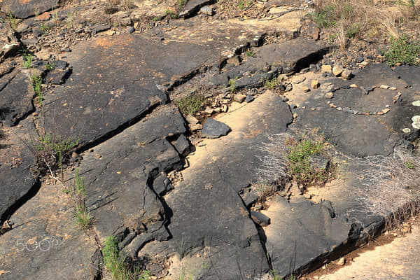
Gathering Affection on a Volcanic Flow by g.T.c on 500px.com

It did cool things down, making Sunday a bit more presentable, though only for a little while.  A relatively early jaunt down to wander the perimeter of Woolly Hollow Lake ended in disappointment.  Usually, that hike ends with a dip in the lake to cool things down.  Said water body lacked in the usual depth, showcasing bathtub temperatures, and weird green things floating in the unusually murky depths.  It stood in stark contrast with the previous day at Greers Ferry, where one could easily 2 meters down, and so that is where I returned to quench my thirst for floating about.


Satisfied with good company and good food, we turned our thoughts and vehicle homeward on Monday.  We diverted through the Bluffton Preserve on the Archey Fork on whim, as a previous visit to the location found it partially closed for hunting.  Suspecting that nobody was much interested in chasing beasts through the burning rainforest, we found it perfect for a little off road adventuring, puddle-jumping and rock-skipping.  


Very likely the most satisfying part of the journey turned out to be discovery that a local community had joined forces to take over the land and maintenance of South Mountain Scenic Overlook, thereby thwarting future commercial development next to our favorite little coffee shop and scenic overlook.

Thursday, June 11, 2026

A Return to Vegas


A return to Las Vegas found it much the same as I had left it two years ago on my first journey into Sin City.  The only remarkable difference proved to be the absence of grandstands for the Grand Prix and the temperature; the latter ensured those not eager to gamble stayed close to the pool only to venture out after the sun fell out of the sky.  October is undoubtedly a better time to visit than June.


For me, conference activities kept me busy through most of the daylight hours.  This engagement carried through to a little pool time in the early evening, before venturing out into the night.  It also prevented much wandering about out of a need to be fresh for more conference activities in the morning hours.  A lack of grandstands offered a better view of The Fountains of the Bellagio and I lingered about that area, primarily.


The hosts of the event offered a bit of sustained entertainment on the final evening there, though not outside of that quarter.  A brief walk through the casino and across the bridge spanning the strip setup an evening of good music, food and beverages under the desert sky.


Very likely, the most interesting part of the journey was as it always is; the view from just behind the wing, high above the earth.  This one activity continually offers the most intriguing sights to be witnessed anywhere and never looks the same twice.

Monday, March 30, 2026

Mineral Baths to Mountain Bluffs

Our Anniversary Escape this year led us to Hot Springs in Arkansas.  The biggest motivator seemed to be that every other attempt to visit the namesake placename has ended in some disruption or another.  The most recent attempt north of Yellowstone in Montana found the place had closed for the season the weekend just prior to our arrival.  This turned out very similar to other attempts too, though not a complete failure.

It is an interesting little town to explore and soak in a little, quite literally and of course, figuratively. While three days felt like the perfect amount of time to get a good taste of the area, a longer stay would be needed, if one were to have an interest in conquering things like the 21 km Sunset Trail.


Hiking was not at the top of this agenda this time, though we did afford time for the Gulpha Gorge Trail, after pausing for a ride up to the top of the Mountain Tower for a look around the valley.  Most of the remainder of the time involved parading up and down Central Avenue, relaxing in a mineral bath and enjoying some delicious German food.

Local art proved itself an unexpected highlight, featuring an array of massive murals climbing three or four stories high. These pops of fresh paint felt like a modern dialogue against the city's historic backdrop, appearing in almost every corner of the downtown area.


Leaving the city behind, the second half of the adventure turned north into the Flatside Wilderness of the Ouachita National Forest.  The detour was mostly unplanned, beyond knowing of a waterfall there that just happened to be along the way.  We found the cascade mostly dry, though an interesting space in the middle of nowhere to visit.  The trek in and out of the location, crawling up and the rough roads offered their own adventure, proving once again that the journey is just as important as the destination.


Returning to our home away from home in Heber Springs offered time to enjoy friends and family and scoot up to Batesville Motor Speedway for the annual dusting at .  It was a bit cooler than last year, and the wind was not quite as tuned into the direction it should have, but not awful.  The drone of engines and a good coating of red clay just feels right on a cool spring night.


A day on my own led me to the North Sylamore Creek Trail.  Road conditions deterred previous transports from enjoying this piece of scenery.  The short route down to the Allison Trailhead is not always in the best of conditions.  This time, well-prepared with a high clearance vehicle, the road presented itself in much more appropriate fashion.


With transport parked firmly in place, a secondary obstacle loomed.  The creek itself it not much where the trail first meets the bank. However, the Forest Service encourages a trek north from there about 100 yards and cross at a much deeper section.  It is undoubtedly one of those little counterintuitive trail quirks.  Perhaps during high water, it is a shorter distance but then again, much deeper still.


Once on the trail, the landscape changes as the trail climbs steadily to meander northerly above the river, enabling spectacular views of where water likely spills over the edge of the bluff high above, in several locations; that is, in damper conditions.  The stretch defines Ozark geology, with hidden caves and weathered karst littering the length of the journey.


After exploring roughly 4 of the 30 kilometers associated with this trail, it was time to think about heading back since I had no clue how long it was really going to take and there were other plans for the evening hours.  Emerging from the wilderness earlier than expected offered time for a quick jaunt over South Sylmore Creek and its swinging bridge.


The road back to Heber Springs from Mountain View takes about as much time as crossing from one side of Kansas City to other.  It is undeniably more interesting though, even if the state continues to push to straighten out the roads and remove the deep valley dives.


Conversation and a good meal brought things to a close for the day, so much so that we completely  lost track of time.  We realized too late that we missed the change to jump over to Sandy Beach to enjoy the sun set on another enjoyable journey into Arkansas.  There is always another chance.


The drive homeward did not really stand out all that much.  Anticipated afternoon storms, coupled with a return to work looming on the morning horizon the next day encouraged arrival at an earlier than normal time.   It had  been another good journey, leaving us with good memories, multiple new additions to The Ozarks collection, and a little red clay all around.


Popular Variations