 |
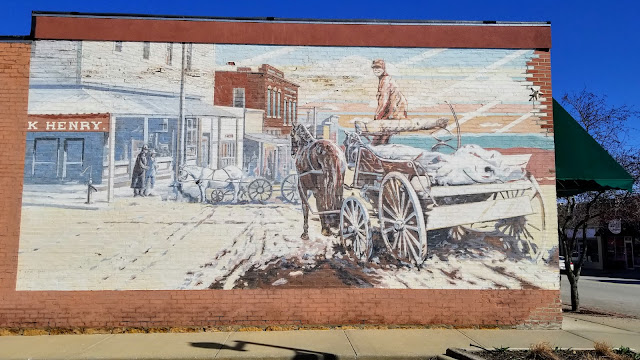
| Building mural in Tonganoxie, Kansas |
Roaming the region around Kansas City at a safe social distance
In all fairness, the virus was not the only barrier. A week long forecast filled with cool temperatures, gloomy days, and endless rain seemed to envelop the entire country. The cards simply were not stacked favorably.
Researching meteorological and contamination conditions on the ground of potential spots within striking distance, a few interesting places offered a chance for a somewhat dry and healthy escape.
The first day out was the longest trek, a 160 km journey to Locust Creek Covered Bridge State Historic Site in north-central Missouri. Accessing the site was easy enough, though could be challenging under wetter conditions. A narrow foot bridge crosses Locust Creek from the parking area and connects with the old road leading to the covered bridge. Rain from preceding days had created a quagmire for about 20 meters from the foot bridge to the raised bed of the old road leading to the covered bridge.
 |
| Locust Creek Covered Bridge |
The old white pine bridge is mostly unremarkable in appearance, but is the longest of four remaining covered bridges in Missouri, measuring 46 meters. Locust Creek no longer passes beneath it quite as often as when originally constructed in 1868 for use as a crucial link within the transcontinental roadways of the nation.
 |
| War Angel sculpture at Pershing State Park |
Only 18 km further down the road, Pershing State Park begged investigation too. Honoring General John J Pershing of World War I, who apparently spent his boyhood playing and hiking in the area, the park offers immersion in the wetland landscape surrounding Locust Creek.
Another bridge of an unknown era crosses into the wetlands, coupled with a boardwalk trail meandering through. With rain stirring and time waning, the acquaintance was set aside for another occasion.
The rain dissipated as quickly as it had appeared, of course. It was really no matter. The brief outing had been good. Wandering the back highways towards home base offered time for peaceful reflection, and occasion to meet Maxine, the “World’s Largest Goose.”
. . .
After some minor preparations for the coming viral apocalypse, some time was set aside time the following day to locate a waterfall only 50 km down the road over in Kansas. That the relatively flat state has anything beyond man-made falls remains a point of curiosity and intrigue.
 |
| Angel Falls in Lansing, Kansas |
Angel Falls is easy to find and even easier to access. A short ½ km paved path behind St Francis de Sales Catholic Church in Lansing leads to a footbridge crossing Sevenmile Creek. The one meter falls are immediately visible from the bridge or after crossing, a short packed earth path leads directly to the base of the falls.
The trail must be a fairly popular destination. Even on this cold and gloomy day in the small town of Lansing, several were out and about walking dogs or just passing through. We kept our distance, and they theirs, quickly departing before the population exploded.
 |
| Riverside Falls in Riverside, Missouri |
Choosing an alternative route home, a momentary pause in Riverside for a look at their falls ended a relatively low-key day.
. . .
Warm sunshine filled the following day, and the temperature soared to about 24°C amid increasing clouds. Certain obligations prevented much wandering about, but a short hike close to home rounded out the day nicely.
 |
| Pond and wetlands near KCPD Trail of Heroes |
The relatively new, and still somewhat incomplete, KCPD Trail of Heroes strolls through nearby wetlands of Shoal Creek and features memorials to various police officials in the history of Kansas City. Recent rainfall washed out part of the 1.2 km trail, but it remained manageable.
. . .
 |
| Building mural in De Soto, Kansas |
Skies were clear and sunny again the following day, but the temperature had dropped significantly to a cool 7°C. Undeterred, some time was spent simply wandering back roads to a point just southwest of Lawrence, Kansas. What is normally only a one-hour trek, took just over 2 hours.
 |
| Wilkey Waterfalls near Lawrence, Kansas |
Situated on the Wakarusa River below Clinton Lake Dam, Wilkey Waterfall is about 2 meters tall. The falls are not much more impressive than those in Lansing, but scenic in their own unique way, as most are. Viewing them is not possible from anywhere but beside them, and it can be a somewhat perilous journey down a steep riverbank to do so, depending upon conditions. Lots make the journey for other reasons though. It is seemingly a popular little fishing hole.
 |
Congregational Church in Tonganoxie, Kansas |
The return trip was uneventful, and not quite as time-consuming as the trip out, but a ice drive under beautiful blue skies, windows down, music up.
. . .
Intending to remain at home base and continue preparations for the coming viral apocalypse, partly sunny skies and slightly warmer temperatures urged further wandering about.
 |
| Captain Creek Waterfall |
Another set of waterfalls lying just south of Eudora in Kansas were proved a tiny bit trickier to locate. The first attempt was a bust, having transcribed coordinates incorrectly. Turning back down the road a couple of kilometers to pick up a mobile signal again, the error turned out minor. The presumed location of the falls were only a kilometer east of where originally marked.
 |
| Captain Creek Waterfall |
Arriving at the corrected location, accessing Captain Creek Falls required only a bit more effort. Traipsing about 400 meters along the associated creek and the boundary of a farm field, the sound of rushing water soon filled the air. They turned out no more impressive than those visited earlier in the week, but they had been located. Mission accomplished.


