Friday, June 25, 2021

The Old House beneath the Earth


Out in the field, a few yardifacts present themselves occasionally. They are remnants of a home that once stood  in that space.  The story goes that it burned down in the late 1950's or early 1960's.  It was later bulldozed and fresh dirt covered the site.  They didn't really bother with ripping out the foundation and every so often a brick of the Mex-R-Co Viking variety appears in disturbed soil.


Other bits and pieces are part of a growing menagerie of items discovered rummaging around the same area.  This small glass vial turned out on the first tilling of an area, after removing the topmost layer of vegetation.


Last year, the tiller struck an object on the outer edge of the area being worked and marked for later investigation.  This spring, readying for the next harvest a little digging by hand around the soil turned up a few bits of plastic. The area was pretty muddy at the time, but a large smooth stone could be seen as well.


Dryer conditions soon offered the opportunity to dig into the situation, literally.


Wednesday, June 9, 2021

Turney Bound


For no other reason than that it was a point on the map, the latest expedition wandered the back roads to land in the tiny little town of Turney, Missouri.  It was a good day to be out on the road one last time, before heading back to the confines of the office space.


Not much is left of the old town, originally laid out in 1869 and named after a state politician.  Only a couple hundred folks call this place home now, though there is evidence that it probably boasted a slightly larger population in years past.   Most homes and businesses are slowly being swallowed by time and the surrounding landscape.


The local historical society has been relatively busy restoring some of the older buildings, such as the train depot that was once a major stop on the Kansas City Branch of the Hannibal-St.Joe Railroad.  The station was was built in 1905, but has been relocated, and reportedly also once serviced the Chicago Burlington & Quincy line.


Another project they have been working on is getting the old schoolhouse in shape.  This was put up a few years before the depot, dating back to 1902.  The last graduating class from the school were issued in 1948, but the building housed elementary students until the 1960's.  Neither of the structures are on the National Register of Historic Places, but are likely candidates for the near future.


There is not much else to see out in this area, excepting other small towns struggling to escape the same fate.  Wide open spaces abound and that was really the goal for this particular journey anyway;  just getting out behind the wheel and watching the highway unfold as the clouds roll by.

. . .

Further Reading

Clinton County, Missouri

Facebook

Sunday, June 6, 2021

BBQ, Waterfalls, and Coffee


Circumventing Springfield to get to Arkansas for a bit of hiking and relaxation.


Heading south again, a minor detour took us through the the small town of  Fair Grove.  It had never seemed significant enough to stop in previously.  Horror stories abound related to the zeal of the Public Safety in administering justice to those traveling too far over the limits of speed.  Our party did not fall into that category, so it seemed safe enough to pause for a moment and have a look around.


A simple note on a rather interesting sign at a local gas depot led to discover of the Wommack Mill, which was built in 1883 and operated through the late 1960's.  The stream seems unlikely able to support such activity and long, and the site does not do much of anything these days, beyond host a reunion, but it is an interesting old relic from days gone by.


Pushing southward, a quick detour aided in avoiding the greater Springfield metropolitan area.  Winding two-lane highways quickly unfolded in front of the vehicle.  There is not much to see out this way.  Folks are living their lives, doing a little fishing here and there along Brushy Creek, and wishing each other luck and love in their travels.


Avoiding Springfield had little to do with the mess of traffic in that town, leaning more towards a simple journey across Bull Shoals Lake on the The Christmas Barge.  This is undoubtedly one of the best parts of this particular route.  The lake was higher than usual with all the rains and many of the surrounding recreation areas were flooded beyond recognition.  The ferry continued is task with undying loyalty though.


Yellville offered up a relatively new BBQ Spot spot, meeting and exceeding expectations.  It is not entirely certain that this establishment is new.  It did not appear as much from the outside, but it seems the staff may have mentioned they were somewhat new and were being featured in some coming feature news story or another.  They were delicious, well worth the stop, and noted for future reference.


One thing led to another, and as quick as the sign appeared, a detour to Rush Historic District led to some minor exploration of the surrounding site.  The navigator came ill-equipped for climbing the trail up to the abandoned mines, but insisted anyway.  It was likely just as hot as on the last visit and with the weekend looming, many more visitors loitering about.


Arriving at the final destination, the following day was filled catching up with good friends, good conversation, and a bit of hiking about some of the favorite spots.  Mossy Bluff National Nature Trail is probably one of the best places to start.  There had been quite a bit of rain in prior days, so flowing water was not difficult to locate.


A stop at Bridal Veil and Cornelius waterfalls found those both running well, with quite a contingent of other folks out and about.  Cornelius is beginning to become a little too popular but fortunately, Bridal Veil remains somewhat elusive to most travelers  A new curiosity was found near that cascade too, a small memorial to a little one lost.  


Topping off the evening, a stroll through the forest surrounding Sugarloaf Mountain helped dinner settle in.  It also worked most of it off, as the navigator got an itch to climb the southern summit route.  The climb was not too difficult.  The few extra pounds and post-meal lethargy made it a little more challenging than usual.


The return trip the following day proved mostly uneventful.  Steel gray skies and random periods of heavy rain deterred any notions of detouring from the primary route.  The only stop of interest turned out to be the freshly painted coffee shop at the top of Devil's Backbone near Marshall.  It seems the owners took advantage of the time off from the masked hysteria to make the quaint little spot all the more quaint.


. . .

Further Reading

Fair Grove Historical & Preservation Society

Google Maps

Arkansas.com

US National Park Service

Mossy Bluff National Nature Trail in Arkansas
Medium

AllTrails

Sugarloaf Heritage Council

Google Maps

Tuesday, June 1, 2021

Niobrara Blue Skies


It started with the intent of finding skies uncluttered by multiple layers of clouds, an effort to rediscover wide expanses of blue that had been missing for what seemed like months now.  It had really only been a couple of weeks, but other factors had inflated the feeling of nausea at facing another yet day in the gray.


The clouds began to peel away near Hamburg in Iowa, setting the stage for a perfect day of wandering distractions.  It had been more than 10 years since traveling this particular path and the favorable weather encouraged a diversion from the interstate out onto the two lane highways of Nebraska.

Quite by accident, the first stop of the day found a few oddities lurking about a site that had languished in the backlog for a couple of years.  There is more to Arbor Lodge State Historic Site in Nebraska City than noted on a previous brief expedition, stimulating thoughts of a more thorough investigation on the next pass through.


The point most responsible for the diversion through Nebraska City appeared in short order, offering up a cool, shaded walk through the woods to a small waterfall at Platte River State Park.  The flow across the limestone bed was probably as spectacular as it gets with all the recent rain, unless one happens to be on-site during a heavy downpour.  The winding trails to and from enabled the perfect respite from the road nonetheless.


Gasoline became of paramount importance after departing the previous scene and wanting to avoid the more populated Omaha, nearby Ashland seemed as good as any destination to fulfill that need.  Open farmland flowed by offering few sites until suddenly and unexpectedly an SR-71a Blackbird and an array of rockets ready for launch standing in the late morning sun demanded a pause.  Unprepared for an in depth investigation, the Strategic Air Command & Aerospace Museum was only noted for future exploration.  Plans for a return to this site are already in the works.


Continuing to meander northward, clouds threatened to spoil the sky and adventures of the day near Fremont.  They were not a welcome sight, having only just left a region recently buried in the gloom of clouds and rain.  Sitting and waiting on a train to pass for what seemed an eternity, the clouds moved along about as quickly as the train, and skies slowly cleared over the next few hours.


The clouds thinned and dissipated as the journey seemed to go and on with nothing of significance along the way.  That Kansas feeling was creeping in and thinking there might be an interesting artifact or two lingering in the town of West Point, course heading was adjusted to make contact.  The calculation proved accurate.  A beautiful memorial stands where a vacant house once rested, thanks to about a million dollars in donations.  It features several bronze sculptures, which are considerably life-like, as moments frozen in time.  Granite spires and flags representing each military branch, along with a Wall of Honor featuring 600 veterans also adorn the site, presenting a peaceful spot for reflection.


Angling to the northeast, across open fields in various levels of construction, the general plan was to land in Ponca State Park by sunset.  There was so much daylight remaining within 60 km of the site that another diversion quickly became obligatory.  Plan B was to overnight at Cottonwood Recreation Area, just below Gavins Point Dam and Lewis & Clark Lake.  Arriving there about an hour later, yet more daylight encouraged traveling on to Plan C.


Niobrara State Park demanded a stay for the night.  The setting sun contributed to the decision as much.  There was enough time to locate the perfect site on a bluff above the Niobrara River and setup camp across from a pond, shaded by a nearby hillside.  


As the last moments of daylight faded away and the campfire died away, creatures of the night became more restless and nosy.  Several times, I heard beasts passing near accommodations for the evening.  A couple of critters spent some time curiously sniffing the boundaries of the tent before moving on. It made for an interesting experience, but nothing too discouraging.  Sitting quietly and waiting for them to pass seemed just and fair.  There was no call to go jumping out of what was obviously a strange and foreign object in their path and frightening them.  They eventually moved on and frogs, crickets, and birds slowly faded away into a tranquil soundtrack for a good night's rest.

. . .


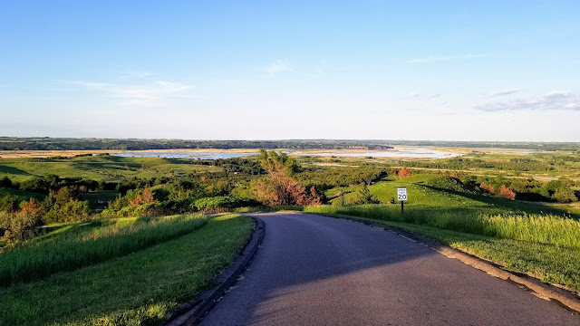
Increasing birdsong led to awakening to a fantastic site of the Niobrara River and, after closing camp, an even more fantastic view of the wide expanse of the Missouri River at this juncture.  Hiking about led through the associated lands, interesting in their own particular way, though likely not so much to the everyday individual.  One point of interest had been devastated in a prior flood.  While touted as something to see, the Ranger assured there was nothing left to see of the location in which the Mosasaurus had been exhumed.  


With the hour nearing noon and facing a 5 hour drive home, it was past time to depart this land of sweeping prairies and native tallgrass.  Over the next hour or two, it would be the only thing to look at, while searching for sustenance of the breakfast sort.  There were an overabundance of places to eat along the way, if you had time to linger until supper.  


Breakfast finally appeared at the end of the Outlaw Trail in the tiny town of Willis.  Granny's proved to be a lifesaver, serving up a feast worth taking some time to enjoy.  They provided friendly company and a multitude of advice on the quickest route home, musing over my weathered look and navigational charts, noting the arrangement as that of "a dying breed."  There is no better way to travel though, excepting maybe throwing the maps out the window altogether and just winging it.

Satisfied and on the road again, reluctantly nearing the dreaded interstate, one last item demanded a brief pause.  Sentinels of the Prairie near Jackson showcases an excellent selection of vintage windmills from the 1880's through to the 1930's, most of which are from Nebraska, positioned neatly at the entrance of the local trash collection company.


Other points of interest appeared in and around the small town of Jackson.  Time was fading away though and all but one, a small memorial containing an Irish blessing "In Honor of All Mothers," were saved for a future adventure.  


The interstate is a crowded and lonely place, offering few distractions, but undoubtedly the most expedient path to any particular destination.  It is not the avenue of choice, by any stretch of the imagination.  No other points of interest beckon as much as those immediately obvious that do not require the aid of a gigantic billboard demanding that one turn around now because you missed it.  Descending along the Missouri River valley, watching yet more rain roll across the plains near Lawrence, Kansas towards home proved to be the only thing to truly instigate the desire to turn around.

(Map only displays that portion of this journey to Niobrara State Park)


. . .

Further Reading

Nebraska Game and Parks

Nebraska Game and Parks

Ashland, NE

West Point, NE

Nebraska Game and Parks

RoadsideAmerica.com

Google Photos No Longer Free

We launched Google Photos more than five years ago and since then, it's become more than just an app to manage your photos. It's become a place you go when you feel nostalgic and want to reminisce. Today, Google Photos is the home for more than 4 trillion photos and videos, including yours, and a remarkable 28 billion new photos and videos are uploaded every week. In order to welcome even more of your memories and build Google Photos for the future, we are announcing a change to our storage policy.
Starting June 1, 2021, all new photos and videos backed up in High quality will count toward the free 15 GB of storage that comes with your Google Account or any additional storage you may have purchased, the same way other Google services like Google Drive and Gmail already do.
All photos and videos you back up in High quality before June 1, 2021 are exempt from this change and will not count toward your Google Account storage. This includes all of your existing content uploaded in High quality.
We don't take this decision lightly and we acknowledge that this is a big shift, so wanted to let you know well in advance and give you resources to help you navigate this change.
Do I need to do anything right away?
No, you can continue to use Google Photos to back up your photos and videos. After June 1, 2021 we will reach out and send you reminders when you are nearing your storage limit. Most users will have years before they need to take action.
When will I reach my free 15 GB of storage?
We created a personalized estimate that shows how much time you have until you reach your quota. This estimate takes into account how frequently you back up photos, videos and other content to your Google Account.
What can I do to manage my storage?
On June 1, 2021, we will be launching a new storage management tool which will help you easily find and delete dark, blurry, and otherwise unwanted content. You can also purchase more storage with Google One where available.
We are grateful that you choose Google Photos to safely store your memories. This change enables us to keep up with the growing demand for photo storage and remain focused on building Google Photos for the future. To learn more about this change, check out our Help Center article or Blog Post.
Thank you,
Your Google Photos Team


Popular Variations