Saturday, July 23, 2016

Crossing Kansas out of Colorado


Eastbound out of Winter Park, through Denver, across Colorado and Kansas.


After one trip down to the village for breakfast, the path began winding down through Berthoud Pass.  The weekend had come, a festival was planned, and traffic headed into the little mountain town with increasing frequency.  Our plans coincided perfectly with everyone else.


A return to the harried civilization at the foot of the front range seemed not quite so pressing.  One last chance to enjoy peaceful solitude along the banks of a clear running stream stood more important as the trail turned east towards the chaos of the Interstate.  


Denver offered the much anticipated increasing array of chaos until finally arriving in the northern suburbs.  A brief visit with comrades from that town found a continuation of a unique style of painting. The recent move to the mountains seemed to have changer the scale of the work though.  Some pieces were as much 2 meters long.


Beyond the hustle of Denver, the new sentinels of the prairies dotted an otherwise blissfully empty landscape. It remained the Interstate though.  While an undesirable route, it had offered the opportunity to spend the previous day relaxing in Winter Park.


It also enabled a stop at a favorite location in Burlington, just before the jump into Kansas.  The Kit Carson Carousel is always a fun treat, if the season is cooperative.  One of about 150 remaining wooden carousels carved in the America, it is protected inside a wooden structure, but is not open year round.


Otherwise, this survivor of the last few centuries resides at the Kit Carson County Fairground and regularly spins visitors up to 19 kph. While the animals do not go up and down, this sixth of 74 carousels built by Philadelphia Toboggan Company between 1904 and 1933, is one of the fastest!


The plains across I-70 unfolded at lightening speed, offering few opportunities to really stop and soak in the wide-open landscape. Feed lots, freshly harvested fields and the sun raced by though the remainder of the afternoon. It eventually gave into little more than the lights of passing traffic and home.


This 3,800 kilometre journey comes to a close.  The adventure across the Front Range, into the Uinta Basin, and back again witnessed some of the most beautiful landscapes and offered up multiple new opportunities for future excursions.
. . .

Further Reading


Friday, July 22, 2016

Winter Park Chill


A pause in Winter Park to enjoy the summer solitude on and below the surrounding peaks.


Rising relatively early and gazing out upon one of the goals for the day, we quickly ventured down  to the village along the Village Cabriolet for a quick breakfast.  The offerings were just as scant as the previous night. Sustenance soon appeared, after a little exploration, and our expedition to Colorado Mines Peak began.


The journey started at the base of the peak at Berthoud Pass, zig-zagging to the summit in long, manageable switchbacks through the treeline.  A short conversation with others on the trail suggested a diversion towards Mount Flora and so it happened.  Reaching neither summit made no real difference.  The view from any angle proved astounding.


With a storm similar to the prior afternoon threatening, we passed back down into Winter Park to take a look around.   A late lunch in town enabled conversation about the remainder of day.  It never did rain and with the evening coming on, another destination offered a good way to ends things.


The best angle of attack appeared to be from the very southern end of Winter Park, where it cuts back into the forest along the river.  Walking through town did not seem all that appealing and led to the discovery that it connected with accommodations at The Vintage Hotel in just under 3 kilometres. Transportation remained parked at the point of beginning, requiring a return trip. It was of no consequence.  The early evening could not have brought more perfect conditions this high up in July.


Acquiring further sustenance for the evening, a a brief walkabout Winter Park Village enabled a view of the associated amusements.  One could imagine potential crowds milling about the different options amidst snow all around in the winter.  Milling about, talking and walking, time slipped away.  The moon rose over the mountain tops without warning.  Coupled with the effort to reach early elevations of 4,006 meters, it signaled the end of the evening.  A more perfect day of wandering ended quietly at 2,780 meters, give or take a couple.

. . .

Further Reading

Arapaho & Roosevelt National Forests Pawnee National Grassland
US Department of Agriculture - Forest Service

Winter Park, Colorado

Winter Park Resort

Thursday, July 21, 2016

Dinosaur Storms


Colorado / Utah Road Trip Day 7: Vernal to Winter Park on the Victory Highway

An early start on the eastward trail crossing eastern Utah into Colorado, the Uinta Mountains faded the rear view mirror.  Clear skies and a cool morning made easy travel of the short distance to the first detour of the day.


A town just across the the state line, named for the extinct critters, hosted a visitor center and some intriguing wood carvings.  It was not much more than a convenience, prior to investigating other matters lacking as much.  It was a good thing too.


The Canyon Area of Dinosaur National Monument, up to Plug Hat Butte from the highway, offers few conveniences.  The views are astounding though, without going any father than there, only about 7 km from the entrance.  A few minor hiking trails show off fantastic views across Colorado into Utah, and beyond.  Our timetable ensured a return expedition necessary to surveying this area properly.


Clouds began choking the sky as the effort continued east on the Victory Highway and the mid-elevations.  They eventually dump their cargo in a torrential downpour that often reduced visibility to a single kilometre. Peaks surrounding Middle Park stood shrouded behind extremely low cloud cover.


Chasing our party back up into the higher elevations, the atmospheric stalker finally gave up on us at Winter Park. The climb had taken the fight out of it, but not before dumping buckets, one last time, on the quiet little ski town.


The sun began to break through in places, inspiring a bit of a walkabout the surrounding landscape.  An aerial tram provided passage to the village, nearly abandoned during this late July encounter. A few shops stood open and little more.  It mattered little.  The primary objective for the evening involved very little beyond settling in for time to explore tomorrow.


. . .

Further Reading

Dinosaur National Monument - National Park Service

Winter Park Resort

Wednesday, July 20, 2016

Dinosaur Fantasy


Colorado / Utah Road Trip Day 5: Around Vernal

Starting the day relatively early, we followed in the 250 year-old footsteps of Silvestre Vélez de Escalante. Along with his superior Francisco Domínguez, he sought a route to Monterey in California from Santa Fe, New Mexico.


This expedition only sought to uncover the secrets of ancient geology and ecosystems of part of that journey at Dinosaur National Monument.  Those secrets and many more were revealed right along side "those meddling kids."


The sites proved much greater than time had been allotted for, but dazzled and amazed our exploration of the site.  The adventure began at the Quarry Visitor Center, meandered along the Fossil Discovery Trail, the full length of the Tour of Tilted Rocks, across Green River, and out to Box Canyon.  Nestled there at the base of that canyon, the final home of Josie Bassett Morris.  She established her ranch in this fantastical world back in 1913, remaining until her death in 1964.  Hers is an inspirational story of the last of grit and determination.


Much of the same would be required to make way to an undiscovered destination from exploits of the prior day out.  Stopping at the Utah Welcome Center in Jensen, obtaining more accurate maps, a conversation with one of the attendants promoted a more popular heading.  She explained that a more direct route to Fantasy Canyon could be found by traversing Red Wash Road, going on to say that she had hear it was closed.  It was not currently marked as closed, so it must be open again.  Traveling along new asphalt, things looked promising, until the road quickly faded to gravel, then turned to nothing more than dirt and a herd of heavy equipment rebuilding said road.


Ultimately, perseverance paid off on this return to the center of the Uinta Basin though.  The "Road Closed" sign was discovered at the intersection of 45 Highway.  The asphalt improved travel time to the next encounter with dirt.  Shortly thereafter, Fantasy Canyon appeared as nothing more than a solitary parking sign and matching trail marker.  An incredible array of strange and wonderful, naturally weathered, sandstone emerges from clay beds here, taking on various intriguing forms.


Rain looked to roll in on the afternoon.  Sticking to the blacktop of 45 highway, the drive back to Vernal proved relatively uneventful, unless you count being stuck out on the road at a dead stop for half an hour.  Road repairs were underway along this route too, though not quite as serious as those along Red Wash Road.  The delay was mostly harmless and enabled capturing a few picturesque moments and good conversation with the individual moderating traffic on this relatively empty stretch of highway.  Eventually, a few more vehicles came along and out of nowhere it stacked up suddenly, and then we were all on our way again.


Famished upon our return to Vernal, we met briefly with their resident pet pink dinosaur, then immediately made progress towards The Quarry Steakhouse & Brew Pub.  It commanded an excellent position to review the events of the day, serving food and refreshment to sate the appetite.


Still, quite a bit remained in the day, so our party went on walkabout through the immediate vicinity to see all the town had to offer.  Dinosaurs, helicopters, the Uintah Public Library and plenty of  green space welcomed our adventuring, topping off what had been a fantastic day of exploration.


. . .

Further Reading

Britannica.com

US National Park Service

Dinosaur National Monument - National Park Service

US Department of Interior - Bureau of Land Management

Tuesday, July 19, 2016

Across the Roan into the Uinta

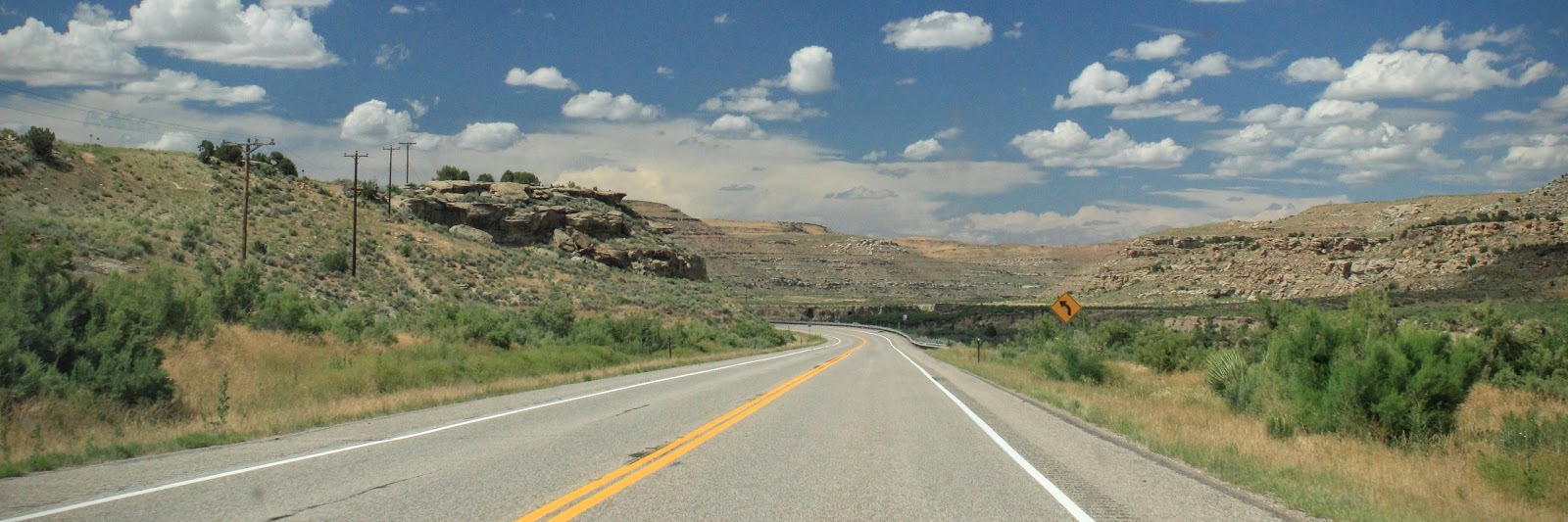
CO-139 Northbound towards Rangely, CO

Colorado / Utah Road Trip Day 4: Montrose to Vernal

The planned journey for the day was only a bit longer than the previous two days, but still a relatively short hop, compared with the test of endurance in crossing Kansas that first day. The approximately 320 km trip from Montrose, Colorado to Vernal, Utah should have only taken about 4 hours.

A couple of diversions, one somewhat planned and the other even less so, doubled that time as we wandered through a National Monument, a National Historic District, and discovered the odd beauty of the Uinta Basin.

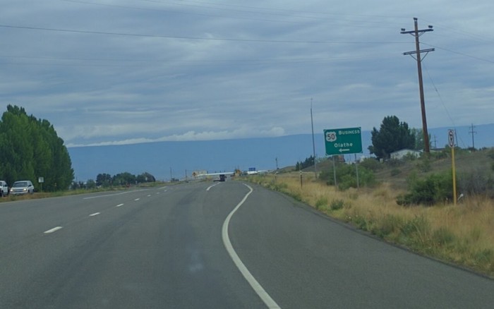
US-50 Westbound near Olathe, CO

Leaving Montrose relatively early, under gradually gathering cloud cover, we made good time west across the Grand Valley. The scenery was mostly unremarkable and again, very Kansas-like, so much so that for one brief moment my heart skipped a beat upon seeing an exist sign for Olathe.
If it were not for the town of Delta, and Grand Mesa consuming most of the background scenery, I might have needed to stop and review the situation more closely.


The Uncompahgre Plateau became much more visible as we approached Grand Junction, along with some rather ominous clouds. They seemed somewhat timid though, retreating as quickly as they had gathered, presumably in search of reinforcements. Indeed, other much darker accomplices lurked just on the edge of the horizon.

Weather is odd in this part of the country. One can sometimes quickly find themselves in a deluge, when it was a perfectly clear day only moments before. Certain that our mission into Colorado National Monument would come to a wet and muddy ending before it even started, we kept a wary eye skyward, in the hopes of having at least a few moments warning.


The sun faded in an out, causing the plateau to glow in brilliant array of sandy earth colors, and our excitement, as much. Maintaining course, we quietly passed through the southern edge of Grand Junction without incident. It was much like any other suburb on a Tuesday morning, excepting the odd biker and his bundle of daises.

Traffic thinned out to nothing as we approached the gate to the monument. Several folks were coming out of the area, causing it to seem as though we were going in through the Out door. Indeed, we were a little concerned with being turned away to enter from the north, as nobody else seemed to be traveling in same direction.


The Ranger waved us through though, and we quickly realized we had accidentally on purpose chosen the best route. Aside from the fact that everyone is traveling the other direction, all of the pull-offs are on the right side of the road, eliminating the need to cross traffic, offering a quick escape from the same. I suppose that if it is important to stop at the Visitor Center before all else, then coming in from the north is more reasonable.

Another good reason to in from the north may relate generally to visibility and safety while driving. It is nearly impossible to see much from a vehicle, coming in from the south. A perpetual fear of driving over the edge of a cliff kept us well focused on the task of driving, and the asphalt ahead of us, leaving no opportunity for viewing while in motion.

We paused briefly at nearly every stop along the way, getting out of the vehicle and wandering the cliff edges, marveling at the beauty of the canyons and the Grand Valley below. The situation was not much safer than driving though. While there are safety rails, they are not along the entire edge. It is imperative to keep wits about you at all times, lest you find the ground absent from beneath your feet.


 My traveling companion could not be bothered with such details. She continuously danced perilously close to the edge, without a thought towards the relative distance between her and the floor of the canyon. On numerous occasions, I was certain she was doomed. All that it would take is one misstep.

I warned her repeatedly that, should she tumble to the bottom, I would not be making the trip down to drag her broken body out of the canyon. Plenty of wildlife lurked in the shadows, eager and willing to take on that task and divide it among them. I saw no reason to participate.

She only mocked my concern, as she continued to hop, skip, and jump her way across the treacherous territory. Somehow, miraculously she remained situated and able to continue the adventure.


The clouds were beginning to boil over again as we reached the Visitor Center. The weather had been perfect up to that time, but rain was definitely imminent. We could see clouds quickly racing towards our position high on the plateau. It would be rainy day in Grand Junction, but our path north and west looked clear.

Almost immediately, the rain started in, as we made our way down into the valley. It did not last long, and was not a particularly heavy downpour, but there must have been some sort of cause for concern. A lone Bighorn Sheep charged across the road about that time, racing for high ground, seemingly certain of a recurrence of the flood that made Noah famous.


The rain left as quickly as it had come though, leaving massive black clouds perched above the plateau, threatening to wash everything into the valley below. It advanced no further, and our course appeared clear for hundreds of miles, so we made our escape before the clouds could give chase.

It should be noted that one should never attempt to drive, carry on a phone conversation, and locate food, while traveling through back-to-back roundabouts. I can tell you from experience that you will accomplish very little beyond traveling in endless circles.


We must have passed back and forth over I-70 at least three times before concluding that a sign in the distance promising “Munchies” would have to suffice. It no longer mattered what we would eat, only that a clear and present sign offered hope in our escaping the incessant circular motion.

After a quick stop for sustenance at this semi-carnival like place, complete children running amuck, we were on our way. We only participated in the food portion. They did have a pretty good burger; although I am not sure I would necessarily go so far as to say it is the “World’s Best.”

Making our way north of Grand Junction, the stretch of roadway, as part of the Dinosaur Diamond Scenic and Historic Byway, turned again to another page from the book of Kansas. The landscape, littered with farms, and the occasional over-priced subdivision, unnecessarily redundant.

The Roan Plateau from CO-139 Northbound just outside of Grand Junction

Just about the time we started to get bored with that scenery, it abruptly changed and we were rising up into the escarpment of the Roan Plateau. Indeed, and just about the time we started to become bored with that, we began winding our way through Sayles Canyon, with minor peaks rising in all directions.

Looking south from Douglass Pass on CO-139

Arriving at Douglass Pass, we were up on top of the world again, in full view of the valley we had come through to the south, and our intended path to the north. The pass is definitely a divide of sorts, perhaps for this particular geological feature only.

We started winding our way back down northward into that valley, and the scenery seemingly flipped from sub-Alpine to near desert conditions. With the scenery becoming dull to my traveling companion, she decided it was time to pass out in the passenger seat.

I found the transition and the new flat and straight deserted canyon road blissful in its abandon. The marks of society could not be found anywhere beyond the road. Semi-arid canyonlands offered the eye a multitude of distractions to keep the hum of the tires out of your head.


Breaking away into a long stretch of flat and narrow, the road introduced a sign of civilization. Although abandoned, the art of human origin all the same. We had stumbled into Canyon Pintado National Historic District, a construct and protectorate of the US Bureau of Land Management.
It was not on the map, had not presented itself through our meager research prior to the trip, and there had been no signs to indicate as much. The reasons would become more apparent with later research. It offered facilities though, and an array of signage explaining itself, so I pulled in for closer examination.


It seems the area was once home to an abundance of some of the oldest and best examples pictographs. Most are gone now, obliterated from the landscape by jealous artists, and careless tourists. It was beautifully silent there now, but not piece of art beyond the signage.

Looking North across Canyon Pintado National Historic District

Exiting our vehicle for a stretch and a few minutes of reading, we took advantage of the available facilities and were on our way in no time. The pit stop had been mildly amusing, in its information, and capacity to jolt my passenger from her nap time. A couple of other travelers had come to spoil the solitude though, so we left while inner peace remained.

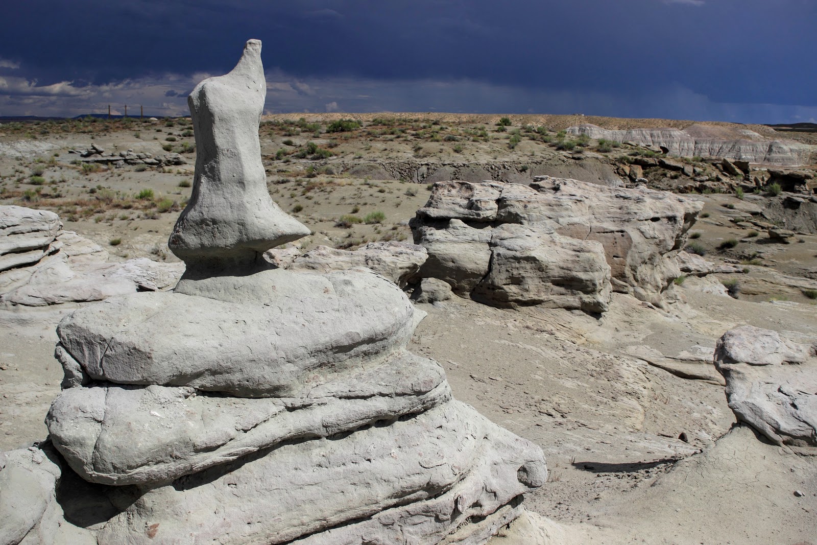
Arriving in Rangely around 2 pm, we only needed another hour or so to make it to Vernal, so decided to go in search of an odd little place we read about online called Fantasy Canyon. We should probably have gone on to Vernal. One would think that find something in the middle of nothing is a relatively easy task, but nothing is ever easy to find in the desert.

We had GPS and Google seemed to know the way, so we were not overly concerned, and detoured across the floor of the Uinta Basin floor and straight into Utah without knowing that we had even crossed the state line. That should have been our first warning. The only indication towards that end, we were on a flat, wide, empty desert basin.

Turning this way and that, we eventually left the County roads and began crossing mostly undeveloped gravel truck routes with no signage whatsoever. We were in the middle of nothing, and there was more surrounding nothing.

Looking across the Uinta Basin Floor in eastern Utah, near Bonanza

We encountered the Bonanza Power Plant, and marked it in our mind for future reference, should things got too far out of hand. As a landmark visible for miles, it is likely the only life for hundreds of miles. Eventually, more signs of life became apparent. I think the area of Fantasy Canyon is some sort of oil or gas field, as the scenery soon became littered with pumping stations.

032505 in Eastern Utah, near Bonanza

Eventually we received guidance to turn down what it only called 032505. The naming convention seemed rather odd, but not entirely out of place in this area of desolation. A small tin shack sat at the intersection of these two paths, with a pickup parked outside. We were not entirely alone, which offered some relief.

Google finally told us to stop and park after passing a short half-mile down this path. Looking out the window, the scenery looked somewhat similar to the photos online, but then not quite as interesting. We got out and looked about, poking around some of the cracks and crevices. Most of the statuary seemed still under construction, and it was certainly of the same formation, but was not the place.


The day had been clear and perfect, up until this time, but the clouds we had lost in Grand Junction, suddenly found us again. They were bearing down on our position quickly, determined again to soak us through. The constitution of the area appeared as though it turned to a sloppy mud hole with the right amount of rain, so we decided to abandon the effort entirely.

Pronghorn Antelope crossing the road near Fantasy Canyon, UT

As we were leaving, a local family of Pronghorn Antelope dropped by for a friendly visit. However, they quickly realized we were not from around there, turned their noses, and left without a word. The pick-up at the shack on the corner left too, and we were alone again with our fearless navigator, Google.

It took quite a bit less time to get back to the main road (UT-45), thankfully. Cloudbursts began dumping rain in random locations all around us in an effort to destroy evidence of our visit and block any attempt to return.

In collusion with the clouds, the State setup a roadblock on our route, under the guise of a repaving crew. Although, a road crew repaving a road that seemingly has no need for repaving is not very good cover; on the other hand, that is a generally typical arrangement.

Split Mountain
After waiting in a mile of traffic for about twenty minutes, we finally escaped. Just over the next hill Split Mountain appeared on the horizon. We were nearing the end of another day.

We arrived in Vernal without further incident, undoubtedly in a world that coveted the dinosaur. A massive pink version of the same welcomed us, and everything had some sort of Jurassic tint to it. It was the least of our concerns though. Hunger was beginning to knock on the door again.

Quickly locating the little roadside motel we had booked for this occasion, we were pleasantly surprised it turned out to the best, thus far. A mini-suite of sorts, it not only had a bed, but also a comfortable leather sofa, and a television larger than any other we had seen in any other hotel.


Our mind was not on any of these items though. We put in a lot of effort throughout day, and hunger was escalating in intensity. Fortunately, we had passed the local Vernal Brewing Company that hosted dining too. Only a block away we were there in no time, relaxing with a cold local brew and some tasty food.


. . .


This is the fourth part of an 8 day journey into Colorado, across the Continental Divide, into Utah, and back again. The previous story discussed travel sights related to the the third day in “The Black Canyon and a Bay of Chickens.”

In the next episode, we spend most of the day around Vernal, and return to the center of the Uinta basin again in search of Fantasy Canyon; this time, with a greater degree of success. It is amazing what you can accomplish off-road.

. . .

Further Reading

Touring through Colorado National Monument

Colorado National Monument


Along the western edge of Colorado, red sandstone monoliths and sheer wall canyons define the northern edge of the Uncompahgre Plateau, a distinct and massive uplift portion of the much larger Colorado Plateau.

Home to Colorado National Monument, it is one of the few places throughout the Colorado Plateau where rock formations from the earliest periods in the history of the Earth are clearly visible, as well as a good portion of the remainder of the geologic time scale for the area.


While it was not discovered by a certain John Otto, this individual ensured it remained relatively intact and accessible for future generations of explorers. After seeing the red rock canyon just south of Grand Junction in 1906 he wrote that “they feel like the heart of the world to me. I’m going to stay and build trails and promote this place, because it should be a national park.”


John spent years collecting petition signatures, spearheading fundraising campaigns, writing news editorials, and blazing some of the first trails into the canyon. Indeed, one of the first blazed for the newly proclaimed monument in 1911 was the Serpent’s Trail, designed exclusively for automobile traffic.


While the trail is no longer open to vehicle traffic, the spirit of his idea remains in the 37 km Rim Rock Drive, which is probably one of the best means of seeing the monument. One can start from either end, but the most interesting views are going to come to those entering from the east entrance to the park. If you can wait for the visitor center until the last, this is definitely the way to go.


There are multiple stops along the way where one can step out to the edge of the cliffs and admire the beauty of geology on a grand and sweeping scale, or even a minute sedimentary scale. The views from high atop this perch bordering the Grand Valley inspire a feeling of awe at the beauty of nature and the forces that created this place.


At every turn, cliffs and canyons created over time expose history, weathered, exposed again, and weathered further. Visible in the distance, from just about every stop is the Roan Plateau on the opposite side of the Grand Valley.


Choosing to enter from the East, Devil’s Kitchen Picnic Area is the first stop, where folks can have a little lunch before carrying on their adventure into the park. The original auto route, Serpent’s Trail is also there.A series switchbacks follow, slowing rising 300 m and passing through a tunnel in the rock to Cold Shivers Point and a breathtaking view of Columbus Canyon below.


Passing along another short stretch from there, leads to Red Canyon Overlook. This hanging canyon frames the City of Grand Junction below. Ute Canyon View comes quickly after that, with an awesome sweeping view of the wide crumbling water eroded canyon. The Upper Ute Canyon Overlook a couple of stops further up gives folks a chance to get a little closer to the canyon walls too.

That is getting just a little ahead of things though. First, one must pass through the highest point along the route, which is approximately 2 km above sea level and then perhaps make a quick stop at Fallen Rock Overlook for more photos.


For those interested in getting down into Ute Canyon and out to Liberty Cap, the trailhead is just before Fallen Rock Overlook. Otherwise, forge on to the Upper Ute Canyon Overlook for a closer look at the canyon walls and an interesting formation resembling a sarcophagus standing on end.


The next stop is a bit further up and into the next canyon, but about half way along another opportunity to hike out to Liberty Cap comes available at a trail of the same name. which crosses over Mesa Monument, with beautiful views of Monument Canyon below. The trailhead for the Black Ridge Trail is here too, just on the other side of Rim Rock Drive.


Highland View seems to be named for awesome views of the surrounding highlands. There is no trail access here, and one could possibly slip over the edge and wander about, though the relative steepness of things here seriously discourages that venture.


The next trail access point is up and around a few bends, overlooking Upper Monument Canyon, at Artists Point. The namesake for this location seems to be the multitude of views straight from the canvas of an artist, with the Squaw Fingers formation just to the southeast, and Coke Ovens formation to the northeast. The Coke Ovens Trail takes folks out to that formation. Another drops down into the valley along the CCC Trail, which crosses the highway there from the Black Ridge Trail to the west.


Another opportunity for a closer look at the Coke Ovens formation is just a little way up around the next bend though, but no trail access is provided. The view of the valley below here is phenomenal, allowing one to scout the terrain along the trail before heading across the canyon. More amazing views of the Monument Canyon appear in the next few stops at Monument Canyon View and Grand View. There is no trail access from either of these, nor is there a barrier against plunging over the edge. Tread carefully here.


The last major stop along the way, or the first, depending on which direction you are going, is likely one of the best views in the park. Although, there really is not a single bad view anywhere along this route.


Independence Monument View takes in the surrounding valley vista, along with the 137-meter formation of the same name. The monolith displays an interesting piece of geologic history within the park, as a slowly eroding rock wall separating Monument Canyon on back side of it, and Wedding Canyon, directly below. There are no trails here, but just a little further up, the short 1.6 km round trip along Otto’s Trail leads out to the Pipe Organ formation, along the Coke Ovens formation.


Just up from the trailhead for Otto’s trail multiple trails converge at the Saddlehorn Visitor Center. The Black Ridge Trail returns here, somewhat paralleling the Alcove Nature Trail, another short 1.6 km round trip. The Canyon Rim Trail wanders the edge around the visitor center, and the short Window Rock trailhead out to edge near the Book Cliffs View at the east end of the visitor center access road.


The Saddlehorn Visitor Center is the primary destination at this location though. Showcasing a wealth of information about the park, trails, formations, and history of the park. The geologic educational displays are really great.


Leaving the visitor center, moving towards the West (Fruita) entrance to the park. The road winds back and forth towards that point, passing through a couple of tunnels and down into Fruita Canyon.

Along the way, stops include Fruita Canyon View, Balanced Rock View, Distant View, Historic Trails View, and Redlands View, just before Dead Man’s Curve and exiting the park. There is no trail access along any of these points.


Wildlife in the park include desert bighorn sheep in the park, along with coyotes, mountain lions, lizards, and desert bighorn sheep. Smaller mammals abound too. Grey foxes, desert cottontails, rock squirrels, and Hopi chipmunks are often hopping around here and there. One interested in birds, bugs, or reptiles will find enough to keep them busy, as well.


This is really a fantastic park to drift through on the way to points beyond, either east over the divide, or west to Canyonlands, hosting backcountry hiking, as well as camping under the stars! The pullouts mentioned are handicap accessible, but the park only offers one “equipped” camping area.


. . .

further reading

U.S. National Park Service


Popular Variations