Monday, November 11, 2013

Background - Restoring a County GIS (Part 2)

I accepted the position of GIS Manager, just as I began my final year working towards a Bachelor of Science in Physical Geography (special emphasis on GIS and karst environments, along with a Minor in History). Little did I know that everything I had learned or been a part of in the past 20 years was about to be put to use.

The position reported directly to the County Assessor, a rural Republican woman from the north end of the County. She had held the seat for about 6 years I think, after being appointed from within the Office by the Governor, following the resignation of the previous Assessor. She was hard-nosed and demanding, while at the same time perfectly clear and reasonable in her expectations. Much like me, she preferred getting down to business with straight and honest answers to questions, and had very little tolerance for folks that beat around the bush. As a result, we got along really well, after testing each other a few times, and I was determined to make good things happen for her, the Office, and the County GIS.

The previous GIS Manager had left the position about 6 months prior to my arrival and only about a year in the position. I later discovered that this was a scenario that had repeated itself numerous times in the past. GIS folks signed on to the position long enough to hold the title, then left for a position in the private sector. There had been no attempt to retain anyone in the position, through commensurate compensation, and there was no interest in doing so. Consequently, the GIS was in a crumbling and dilapidated state, and not really much use to anyone except the persons maintaining and analyzing the records.

A GIS Analyst had only recently signed on, after having been absent from the profession for several years. She was doing her best maintain the data and day-to-day business; that is, in spite of a total lack of guidance, direction, documentation, or procedure, from the previous GIS Manager. I was concerned she would follow the same path as many others that had been in that position, but was fortunate to have her give the situation a chance and stay on through 4 years of the restructuring.

Throughout the County, there were only a couple of others involved with GIS. The GIS Coordinator within the Planning & Zoning Department mostly worked independently on projects associated with his department. Although he really had no responsibility to our office, he enthusiastically joined in most of the projects we rolled out during the next 5 years. The Director of Information Services was an immense help in forwarding our objectives too. He had originally been brought on years before, to initiate a GIS for the County. He had not worked in GIS for quite a few years, but understood the basic concepts; as well as the importance of a structured and well-documented approach to building and maintaining a useful GIS.

While this situation probably would have been quite a challenge for someone just finishing college, I had enough background to make a good run of it. I had already been in the business world for 20 years and just then leaving an Analyst role I had been in for 2 years with a financial software firm. Prior to that, I spent 5 years working with a team in my own company providing creative services, primarily in photography and event production, and pre-social media web marketing and promotional support. For the 13 years before that time, I proved my technical worth, rising through the ranks of a semi-local financial firm in various technology roles from quality assurance, helping structure production standards, statistical analytics, database management, data modeling, software and hardware support, software design and development, and even a little web production in the early days of HTML.

Sunday, October 20, 2013

Initial Thoughts - Restoring a County GIS (Part 1)


During the past 5 years, I spent most of my waking hours rebuilding and restructuring a dilapidated Geographic Information System (GIS) for a Platte County in Missouri.

My team and I restructured systems and data to be more efficient, reliable, and accurate, while fully documenting processes and procedures, and organizing policy towards a functioning business solution using the ESRI suite of products, ArcGIS. Indeed, we only recently positioned our GIS to enable the Assessor and the County to begin to reduce its reliance on taxation and begin generating revenue through a fee structured subscription environment, capable of delivering geographic and non-geographic data to any client in the world, 24 hours a day, 365 days per year.

Resources for GIS were extremely limited, so it was very hands on, and I did most of the work on this system, personally. Along with a GIS Analyst under my supervision, the GIS Coordinator n the Planning & Zoning Department, as well as a bit of consulting on system design, architecture, and setup support from the Information Services Department.

In spite of numerous obstacles, both internal and external, we successfully upgraded all ArcGIS software from version 9.1 through v10.2, and implemented ArcGIS for Server v10.2, while at the same time, migrating this situation from an aging IBM DB2 v8.1 database on a Windows 2003 server to a Microsoft SQL Server 2008 R2 database on a Windows 2008 server.

This multi-part series will document those adventures in full, from beginning to the bitter end, when a newly-elected Republican Assessor, closely affiliated with the Tea Party, made one of several uninformed decisions. In his opinion, an [underpaid] GIS Manager was an unnecessary expense, because “nobody really uses maps anymore;” ironically, just a few days later he realized he had made a mistake. The GIS Manager did not just make maps.

Fortunately for him, the system was well documented and permitted the GIS Analyst to easily step in and start with a good foundation. That was one of project goals, after all; that anyone could easily step in and assume command of the GIS, with little effort. 

Essentially, this is a “Post Mortem” on the PCAO Geographic Information System Project, in every sense of the word, in the hopes of providing some insight to any other GIS Manager or Project Team that may face similar circumstances.

Wednesday, July 6, 2011

Bayfield Walkabout

Touring about the little town on the big lake

Travels led north, intent on exploration of the Apostle Islands National Lakeshore. As the main gateway to this National Park, a little bit of time wandering the streets of Bayfield, Wisconsin fit neatly in the schedule. Accommodations at a nice little roadside motel overlooking Pikes Bay, only 5.5 km from town facilitated the situation nicely. Tucked back away from the road just a little, it boasted fantastic view of the bay, while far enough away from everything to enjoy quiet evenings.


Founded in 1856, the town stood primarily as a lumbering and commercial fishing village, nestled along the east side of the northern-most peninsula of Wisconsin, on Chequamegon Bay of Lake Superior. It is named after the explorer Henry Bayfield, a British Royal Topographic Engineer that surveyed Lake Superior, and is the primary launch pad for the Apostle Islands National Lakeshore.


An annual regatta, Bayfield Race Week was full sail on arrival, and sailboats lurked everywhere. Watching the race from the shoreline can leave something to be desired though. It is difficult to ascertain the status of things, and too many white sails confuse the matter.


The town offered a few hours of amusement, Between glimpses of the race. The only way to escape the antique shops, and assorted eateries is to go wandering by car though.


The Bayfield Maritime Museum captivated attention for a half hour or so; then, the small museum dedicated to the Apostle Islands National Lakeshore (about half as much time there). Walking back through the mostly quiet streets, all entertainment exhausted in an afternoon led to cocktails at the Pier Plaza Restaurant. A before and after a sunset cruise through the Apostle Islands led back to dusk, and finally finally darkness, on the marina of the sleepy little town.


The spot fit the need for escape, with easy access to a few activities, and only a short drive to the other side of the peninsula for other distractions. The weather stood as the most perfect; indeed, according to many of the locals, more acceptable than normal. The mosquito, infamous in that part of the country was nowhere to be found; thankfully.

. . .

Further Reading


Sunday, September 5, 2010

Peppersauce Ghost Town

Bridge Crossing into East Calico aka Peppersauce Ghost Town

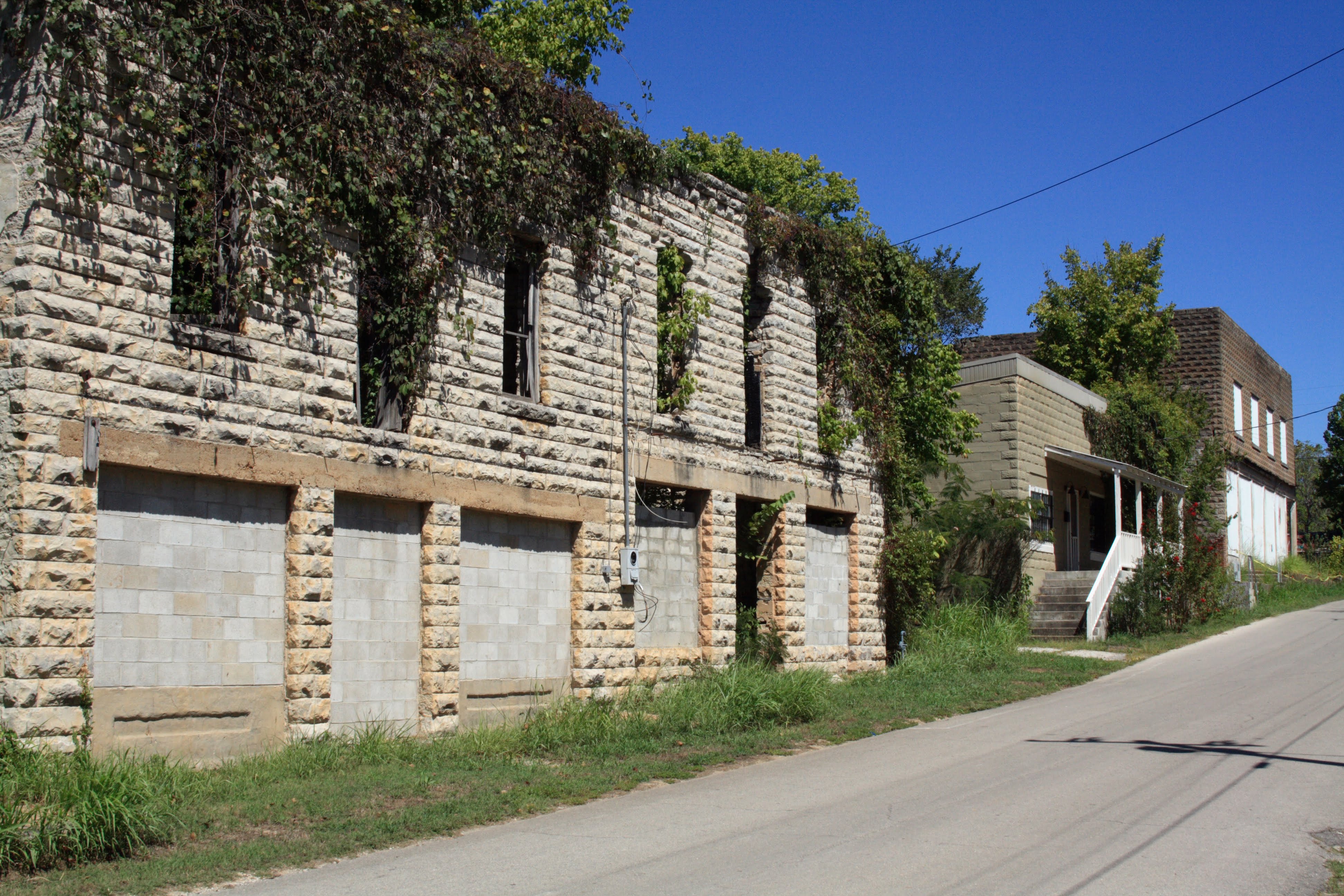
The highway north into central Missouri from Arkansas is full of twists and turns through mostly forested wilderness, and a mostly undiscovered history. It is here that quiet little ghost town attached to a living community sits quietly crumbling on the bluffs of the White River.


East Calico started like many towns of 1800s, as a trading post for French traders and trappers traveling the White River. Numerous little taverns appeared, and the site became home to various thieves, vagabonds, and other troublemakers indulging in “Peppersauce,” the local moonshine; along with that, prostitution, fist-brawls, knife fights and gun battles.


By the 1890s, homes had begun to appear along the bluffs, and a bit of a community started to form. The taverns continued serving though, making the town still a bit unfit for regular folks. News of the intent of the railroad to lay tracks along the bluff in 1902, and the promise of the associated prosperity, encouraged the law-abiding citizens to run the taverns and their patrons out.

In 1903, the train started making regular stops in Calico Rock, and homes and businesses sprang up, providing work for anyone looking. The town hosted a thriving community until the 1940s. A local electric plant closed when high tension lines came through, food and cotton harvests were replaced with cattle farms, and over-foresting silenced the timber mills; folks were forced to find work elsewhere. By the time the 1960s rolled around, the train no longer made stops there, everyone had moved on to other more sustainable destinations.

A few folks remained on the outskirts of town, and many locals still favored the spot for trout fishing, so the area was never completely abandoned. A new prison brought back a few residents in the late 1960s, but the once bustling town that had grown up east of Calico Creek remained empty, and a ghost town. The property was bought up over time, but many of the buildings collapsed, burned, or were overtaken by undergrowth; only about 20 buildings remain today.

... Further Reading …

East Calico Rock Historic District Ghost Town
Arkansas.com

Thursday, July 8, 2010

Skyline Drive Archaeology


Constructed by local prison labor in 1903, Skyline Drive begins its gradual ascent halfway up the ridge, just a short 3 miles out of town by way of Highway US-50; only really a couple of thousand feet from town, by foot.

The narrow roller coaster ride along Skyline Drive

There are a couple of pullouts along the gradual ascent to the top. Visitors can take in views of YMCA Mountain and Fremont Peak to the west, and the Twin Mountains to the north, or inspect excellent rock exposures of the ridge itself, known to be fossiliferous.

Reaching the top, another pullout provides a full 360-degree view of the surrounding landscape; the previously mentioned mountains to the north and the west, and all of Cañon City to the east.

Cañon City from Skyline Drive

This panoramic view continues virtually uninterrupted for the remainder of the seemingly perilous one-mile roller coaster ride across the top of the ridge. There is not much room for error along this portion of the route, and no further pullouts until near the end of the ridge.

Near the end of the ridge, Skyline Drive switches back to the north and begins its gradual descent to the smaller “Hogbacks” separating the ridge from the town, switches back once more, then empties into a residential area.

Smaller Hogbacks below Skyline Drive

There have been numerous new dinosaur fossil finds along the ridge and Skyline Drive over the years, one as recent as 1999. While out for a Sunday drive in 1999, a paleontology student from the University of Colorado discovered dinosaur tracks along the ridgeline. They had apparently been visible for years, but to the untrained eye, just another bunch of rocks.

Closeup of the limestone along Skyline Drive

Excavating the ancient track lines during early 2000, a local crew took molds for display at the local Dinosaur Depot Museum, along with other fossils discovered at that time, including tree roots and branches. Most of the discoveries throughout the years are also on display there. Various signage along the route indicates the location of these finds and explain their history and relevance to the region in detail.


Popular Variations