Monday, July 18, 2016

The Black Canyon and a Bay of Chickens

Juniper at Dragon Point, Black Canyon of the Gunnison National Park

Colorado / Utah Road Trip Day 3: Gunnison to Montrose

With only about 100 kilometers to cover, there was no particular rush to hit the road. We had an appointment to set sail at 1 pm. Nothing planned before, and only generalized plans for the time after that cruise downstream on the Gunnison River for a look around.

We hit the road out of Gunnison rather early anyway, to ensure we had plenty of time for boarding. The skies were blue, with only a trace of the high cirrus drifting aimlessly about, and comfortable temperatures in the middle or upper 20ยบ C.

Entering Curecanti National Recreation Area on US-50

Following along Tomichi Creek, flat farmland quickly gave way to the foothills of the West Elk Mountains bordering Curecanti National Recreation Area. They sneak up on you too, attempting to hide their girth between breaks in the tree line. Mostly successful, you are certain that you are back in Kansas, until the trees dissipate and the landscape races up out of nowhere.

Wilson’s Landing, Curecanti National Recreation Area

We paused only for a moment at Wilson’s Landing to snap a couple of photos before moving on to the Elk Creek Visitor Center. This was an essential stop, as we were not entirely certain of where we were going to catch this boat.

Google Maps had the trail marked, but showed the location of the boat tour a 100 km southwest of the trail. Noting that spot to be nowhere near a water source, we were relatively confident of the accuracy of the trail.

Park Rangers at the Visitor Center confirmed our suspicions and sent us on our way with patches, maps, water, and a reminder to be prompt or miss the boat. It was still early though. We only had another 20 km to go, and another couple of hours before the boat left, so we decided to pause a few places along the way to capture a few photos.

Elk Creek Campground from the Elk Creek Visitor Center, Curecanti National Recreation Area

Around the first corner, the Bay of Chickens appeared. We had never witnessed such a thing, so immediately stopped to have a look at this obvious unnatural wonder. It turned out to be a lie. There were no chickens. We hunted all over the turnout, but could not find a single chicken.

Dillon Pinnacles appeared around another bend and needing some rest, and finding rooms at this location for that particular exercise, we took advantage of the situation. While my comrade checked on availability, and secured a room of her liking, I noted a trail wandering off around the corner and some folks making their way back along the same.

Dillon Pinnacles Trail, Curecanti National Recreation Area

After inquiring about their travels, they indicated Dillon Pinnacles as a remarkable sight just around the curve of the hill adjacent to us, and an easy 15-minute hike. They must have been running the entire way though. As we rounded the bend, the pinnacles were a fantastic sight, but the hike out there looked to be a few kilometers, and we simply did not have the time.

Signage along Dillon Pinnacles Trail, Curecanti National Recreation Area

We abandoned the effort, choosing to simply admire the pinnacles from afar, pondering the time “When Reptiles Ruled.” The kilometer hike to this sign had been effortless, and somewhat so on the return, though the temperature seemed to be stealthily increasing.

Cutting across Blue Mesa Reservoir, we quickly discovered there had been no need to make the hike. The mesa of Dillon Pinnacles appeared in full view across the lake. Clouds were quickly trying to cover up the evidence, but they were not quick enough, and I finally captured a couple of shots; of course, they quickly left, leaving the mesa in full sunlight the moment we left.

Dillon Pinnacles, Curecanti National Recreation Area

We hit a minor snag at this point, thanks to Google Maps. Using their navigation, it indicated we needed to turn on to CO-92 for a short distance. It seemed somewhat peculiar that there had been no sign, when the Park Ranger had promised as much. We forged ahead anyway, confident Google knew best.

While we did get our first glimpse of the real Black Canyon from the top of the dam at Blue Mesa Reservoir, we were wholly unprepared for the journey that Google had in mind.

Parking in the gravel parking lot Google indicated to, I took another quick look at Google Maps as I exited the vehicle. I was shocked! Google intended for us to hike down Cottonwood Gulch and swim across the river in order to meet our ship. It was hot, and a swim might have been refreshing, but we declined the opportunity, preferring a less exhaustive path.


Returning to US-50 and pressing on, much to our relief, the sign we sought appeared just a short kilometer later. Google continued to insist that we needed to turn around. We turned Google off and followed the gravel road to a sign that clearly indicated we were in the correct location.

It was still hot out, but we knew that going down into that sunless chasm it was going to get a little chilly, so we prepared for as much. We also took on a couple of liters of water with us just in case things were not as they seemed. It appeared that would be the trend for day, and we were already drowning our intestines in the dry air of the high plateau. There was no sense in changing that pattern. We had a ship to board.

The hike along Pine Creek Trail to the Morrow Point Boat Tour is not that difficult. A stairway leads 55 meters down along a small cascade to the very bottom of the canyon and the Gunnison River. The only difficult part of the hike is the return trip up all of those stairs, which we duly noted on the way down.

Pine Creek Trail and Gunnison River, Curecanti National Recreation Area

Quite literally, a walk in the park, the journey along the trail is really quite pleasant, with the rushing sound of the Gunnison River echoing off the steep canyon walls all around. It is like being inside of a waterfall without having to get wet.

The trail extends another half km beyond the launch site, and I did wander down that direction to inspect the situation. There was not much more, but I was successful in wasting enough time so that on my return we were ready to set sail.

Morrow Point Tour Boat, Curecanti National Recreation Area


After ensuring women and children were also properly secured in appropriate vestments for the occasion, our narrator briefed the twenty or thirty of us on our upcoming journey. He fired the starting shot without much more delay, and the crowd raced the gangplank for the very seat they had been fixated on from the port.

We proceeded effortlessly downstream taking in fantastic views of this canyon from the perfect vantage point, the very middle of the river. We passed astounding formations, with folds, fractures, and intrusions running in a multitude of directions up craggy walls.

Curecanti Needle on the Gunnison River, Curecanti National Recreation Area

Chipeta Falls appeared in short order, cascading beautifully over the edge, dumping Corral Creek hundreds of meters into the river below. Our narrator provided a detailed explanation of this process and they had foiled any attempt of the creek to deposit rocks and sediment on the original valley floor by simply damming up the river. It is quite an ingenious idea actually.

Chipeta Falls, Curecanti National Recreation Area

The Ranger also did a fantastic job of detailing the geology of the year in broad strokes, mixing in enough trivia to ensure nobody got too bored. He was an animated and friendly sort, one of the fortunate few that had volunteered his way into Park Service years ago, and enjoyed a relatively comfortable life simply keeping folks educated and informed. He assured us that those days are gone, but there were still plenty of volunteer opportunities all over the country.

Continuing past the Curecanti Needle, a giant ragged tooth jutting up from the canyon floor next to Blue Creek, we learned of its significance in the Denver & Rio Grande Western Railroad. After hearing the tale, and the role of this scenic ride through the great canyon, it did seem to be the most appropriate image for their logo.

Denver & Rio Grande RR logo and Curecanti Needle, Curecanti National Recreation Area

We turned our attention briefly to the other side of the canyon to wave at hikers examining their adventure for the day from the heights of Pioneer Point. Several had started early enough to have already reached the bottom, and mocked their adversaries lingering at the top.

Without much fanfare, Kokanee Bay arrived and we turned about and headed back upstream to our point of departure. It seemed to take quite a bit less time, thankfully. The water I had taken on, coupled with the sound of rushing water all around was beginning to necessitate a port of call.

The clouds finally refined their organizational skills, and threatened to unload on us. It rained lightly and briefly, just enough to dampen everything, but not enough to break out the life vests. After expressing our thanks and gratitude to our guide for a scenic and safe journey, we quickly and easily traversed the trail back to our waiting vehicle. Part one of the adventure for the day had concluded with relatively few incidents.

US Geological Survey Bench Mark at Black Canyon of the Gunnison National Park

We spent the second half of our day wandering the asphalt trail of another part of his massive geologic feature known as the Gunnison Uplift, within Black Canyon of the Gunnison National Park. Having heard tales of this canyon from friends over the last couple of years, I was anxious to get a good look at it for myself.

Not knowing exactly how long we might get lost in that sector, we decided to bounce on down to Montrose and check-in at the hotel. We stuck with a franchise on this particular night, as almost all of the mom-n-pop shops had displayed terrible reviews when he had researched them earlier.It must be endemic to the town though, as the Baymont had its share of issues as well.


We dropped our bags in the room and vacated quickly, finding our up to Black Canyon without incident. It was somewhat poorly marked from US-50, but since there is not a lot out there, it is hard to miss; that is, unless you are asleep at the wheel.

The excursion early in the day simply does not do the canyon justice. It was indeed a fabulous journey through the lower canyon, but nothing compared to peeking over edge within the national park area. The sheer walls and depths of the canyon are amazing, and Precambrian exposures immediately available to the naked eye; a geologists dream come true.

After a brief stop at the Visitor Center, and a short look over the edge of Gunnison Point just behind it, we continued on to the various pit stops along the way. It was amazing that all of them offered the opportunity to get right out on the edge of things and test your balancing skills.

Looking straight down at Painted Wall View, Black Canyon of the Gunnison National Park

I am well acquainted with my own expertise in that area, but my travel companion is always concerned her skills may be waning, so enjoys every chance to practice the tightrope walk. This occasion was no different, but I reminded her numerous times that should she make a fatal mistake, I would not be crawling down to drag her out of one of the multitude of poison ivy encrusted crevices.

We did not have a lot of time anyway, as it was late in the day. There were about 10 overlooks to visit, all with relatively short trails, each with as fantastic a view as the previous. We spent our time on the short strolls; Pulpit Rock, Cross Fissures, Chasm View, Dragon Point, Sunset View and finally High Point.

Mountain Lion signage at High Point, Black Canyon of the Gunnison National Park

I was kind of hoping to be able to make it down to Warner Point, but by the time we reached the trailhead at High Point, much of the day was gone. We pondered the thought, as we mused over a warning about Mountain Lions.

The sign explained in detail how to deal with such a situation, but it seemed peculiar to place such a warning, at the end of a series of trails where one might have already encountered such a beast. There were none immediately present though.

It seemed as if nothing were moving at that end of the park; indeed, very few people were about. We had seen no wild life among the Pioneers and Dwarf Forest of the crags. The views were fantastic though, particularly at this station. The Gunnison River wound its way through numerous cascades below in both directions.

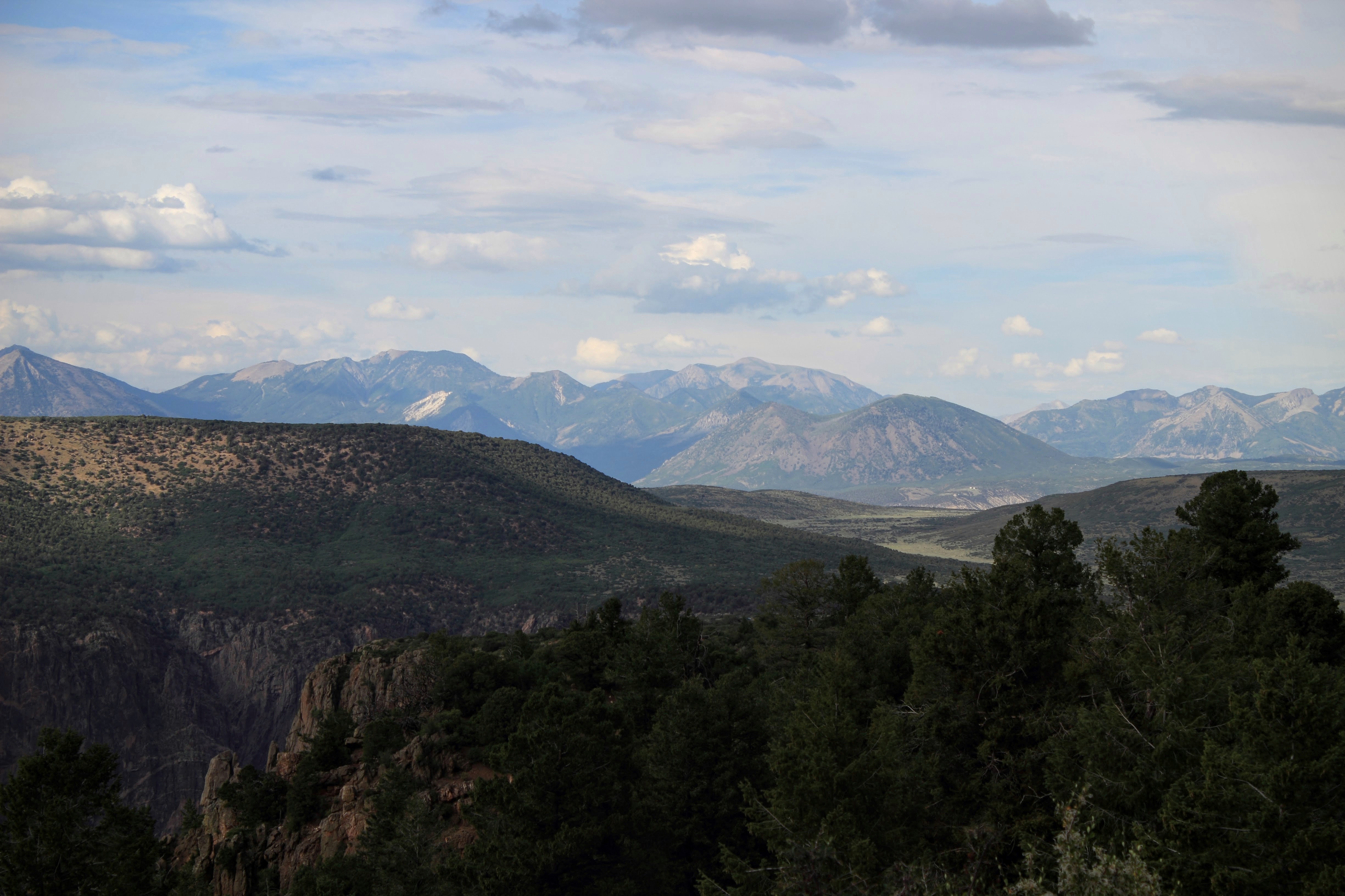
West Elk Mountain Range with Painted Wall in the foreground, Black Canyon of the Gunnison National Park

The Painted Wall seemed a bit more colorful from here than at the point specifically planned for its viewing, and one could gaze in wonder across the uplift towards the even higher peaks of the West Elk Mountains.

It was magnificent, and a hunger began to claw at our guts, a special kind of yearning that only mountain hiking and exploring canyons can deliver. There is just something special about these kind of adventures that leave a person wanting more.

West Elk Mountains from High Point, Black Canyon of the Gunnison National Park

However, we quickly realized it was not the paradise we stood in causing this feeling; rather, our neglect in acquiring sustenance. Warner Point was officially out of the question, and we headed back down the asphalt trail of the Black Canyon, making one last stop at Tomichi Point.

Clouds were looming, darkening the skies, and threatening to drown us as we exited the park. A few cattle made every effort to block our exit. They were just not fast enough and we managed to escape just in time, leaving them bellowing in protest from the middle of the road. Other drivers were not so lucky.


A minor cloudburst crossed our path as we made the descent back down to US-50, but it proved short-lived and insignificant overall. We passed quickly into Montrose without further incident, dropped in on Ted Nelson’s Steakhouse for an excellent meal, and then pretty much passed out from all of the sailing, running, jumping, crawling, hiking, climbing of the day.

Rain sweeping through the Cedar Creek Valley near Montrose, Colorado

This is the third part of an 8 day journey into Colorado, across the Continental Divide, into Utah, and back again. The previous story discussed the arrangements regarding the second day, “Crossing the Divide.”

In the next episode, we make cross the desert into Vernal by way of Grand Junction. We only got a little lost.


. . .

Further Reading

A closer look at Curecanti National Recreation Area

Resources and Recreation in Black Canyon of the Gunnison National


Black Canyon Of The Gunnison


One river and two billion years created one of the most impressive canyons in the United States, a showcase of geologic time, and home to a fantastic National Park named for the feature dominating the surrounding landscape.


The Black Canyon, a dark and shadowy abyss cut by the Gunnison River, was first designated a National Monument in 1933, and later a National Park in 1999. Containing the most dramatic and deepest 19 km of the entire 77 km long canyon cut by the river, it is a natural wonder like none other, and Colorado’s own Grand Canyon.


It is one of the deepest and steepest in all of North America, dropping 829 m from Warner Point. At The Narrows, it is only 12 meters wide at river level and up on the rim at Chasm View, 335 meters. Throughout the entire length of the canyon, the average descent for the river is 8 m/km, and the most extreme again at Chasm View, where the river cascades 45 meters over one kilometre.

The extremes permit an average of only 30 minutes of sunlight in a day, and some parts never see any light, especially during the winter months. These conditions enable the Black Canyon to host its own weather, unique environments and ecosystems, most obvious in the opposing walls. The north side tends toward much less vegetation and craggy walls, while the south side has much more vegetation on a slightly gentler slope, but not by much. The canyon remains an obstacle, regardless of the approach.


As with most obstacles, many perceive it only a greater challenge than their last. Hiking opportunities abound in this National Park, though most choose the less confrontational auto tour. The routes offer some great short hikes right out to the edge. Most have guard rails, but some do not, so take caution.

There are two auto tours, one for the south rim, and another for the north; neither travel close enough to the rim to enable viewing of the entire canyon from the comfort of your vehicle. The south rim is the most popular, but to get the full impact requires getting out of the car, at minimum; otherwise, just a short walk along sometimes paved or hard packed trails.


Meandering relatively close to the edge of the immense canyon on either side, both routes close to vehicular traffic during winter months. The road into the South Rim The Visitor Center at Gunnison Point is still accessible year round, as are all other pedestrian activities.

Along the north rim, only a few steps take you to the edge of the canyon, while the along the south rim, one generally has to hike a few hundred yards; both sides are flanked at either end by extensive trails that lead to unique views of the canyon and surrounding countryside. It is also the location of the two campgrounds within the park.


Entering the park from the south, the first that one encounters is Rim Rock Trail. It follows a relatively flat and easy 0.8 km path away from the South Rim Campground, along the rim of the canyon through Tomichi Point overlook, and then on to the South Rim Visitor Center and Gunnison Point.

One can easily connect with the 3.2 km round trip Oak Flat Trail loop from the visitor center, which wanders through a thicket of Gambel Oak to some rocky outcrops with fantastic views, before ascending back up through a forest of Douglas Fir and Aspen. At a point where the trail wanders back near South Rim Road, a bypass cuts over to the road for easy access to the Uplands Trail, skirting Jones Summit and returning to the Rim Rock Trailhead.


At the end of South Rim Road another trail leads to one of the more spectacular views in the park, Warner Point. The 2.4 km round trip starts at High Point Overlook and wanders out to the edge of the canyon, through mountain mahogany, pinyon pines, and juniper. This is probably the best view in the entire park, with the Gunnison River far below, the San Juan Mountains and Uncompahgre Valley visible to the south, and the West Elk Mountains to the north.

Over on the north rim, the 11.2 km round trip North Vista Trail heads out to Green Mountain through sage, oak brush, then up into the pinyon pines and juniper forests, with multiple overlooks along the way. There is also a diversion over to Exclamation Point, which is only a 4.8 km round trip, for those uninterested in making the long journey out to Green Mountain. Either trip is a workout though.


A slightly easier path lies further down the road on the north rim, along Deadhorse Trail. While it is an 8 km hike from Kneeling Camel Overlook, it is a relatively easy walk along an old service road. An unnamed loop wanders out to the edge of canyon about half way along; otherwise, the trail leads out to Deadhorse gulch, and nearly opposite East Portal.

It is possible to hike the inner canyon too, but there are no maintained or marked trails in this region of the park. Only the experienced and those in excellent physical condition should attempt the descent. Encounters with wild life, extreme poison ivy, and potential for disorientation are higher than normal in any other canyon. Most trips down into the canyon will consume half or all of a day. While it will seem relatively easy going down, the geology ensures that the return trip will take twice as much time.


Geology is what makes this park unique. Along with other erosion effects, the Gunnison River has etched a permanent mark on the Colorado landscape, two billion years in the making. Indeed, it may very well be there in another two billion years, and deeper still.

The Black Canyon of the Gunnison marks a relatively indistinguishable boundary between two physiographic provinces, the southern Rocky Mountains to the east and the Colorado Plateau to the west. While both regions are generally similar, the intense folding and deformations present at this location portray different geologic processes.


At the foot of the mass of laccolith peaks and volcanic mesas that make up the West Elk Mountains, the Gunnison River cuts through a massive uplift in the landscape that occurred about 65 million years ago.

Precambrian basement rock bulged upwards, increasing the elevation from near sea level to several thousand feet above. Erosion effects of wind and rain, running water, and freezing temperatures were probably negligible until this time, and then all such processes accelerated.


Most streams flowed away from the area and began wearing down the Sawatch Range immediately to the east, though some continued their effort on the newly formed Gunnison Uplift. The Sawatch Range diminished significantly over time, and any soft sediments covering the uplift, scoured away. Only a broad, flat plain remained, where various streams meandered, and all was relatively peaceful again.

Volcanic events returned to the region after a time, depositing mountainous piles of debris, creating the West Elk Mountains and the San Juan Mountains to the south. Most drainage diverted around the south side of the West Elk Mountains and directly across the buried Gunnison Uplift.


As the region stabilized, the Gunnison River, now the only significant stream remaining became trapped and unable to alter its own course. It carried away all of the softer sediment covering the uplift, and with the help of other erosional factors, started cutting into the old Precambrian rock, permanently entrenching itself and sealing a fate of gouging out the incredible topographic relief of the Black Canyon.

Recent changes to the surrounding landscape have altered the geologic and environmental systems within the canyon. The Park, along with the associated Recreation Area to the east and the National Conservation Area to the west, attracts millions of visitors every year. For a system as dynamic as exists in this space, one capable of identifiable change within the span of a human life, some of the more pressing concerns relate to protecting geologic resources.


Ongoing paleontology discoveries within the area, exclusive to the Morrison formation that exists through much of the Colorado Plateau, are crucial to better understanding the life of the canyon and life within the canyon. These resources identify how the feature has reacted and responded to changes in the environment and are necessary to adapting and allocating future use of other biological and geological resources.

Mining is one of those primary interests, and has been since the mid-1800s. The Precambrian metamorphic and Precambrian rock hosts gold, silver, titanium, copper, vanadium (a steel additive that increases tensile strength), among numerous other highly prized metallic ores. As well, uranium deposits known to exist throughout the Morrison Formation are of keen interest. As demonstrated through past experience and scientific analysis, any sort of mining activity can and usually does lead to water contamination, which would affect the delicate ecosystem within the park.


Water is probably the biggest concern of all. This part of Colorado sees about 20 cm to 25 cm of rain annually, typical of a semi-arid climate in which water is always one of the most important resources. The Gunnison watershed, confined to the canyon and the immediate area, is critical to continuing agricultural production for the region.

Dams and diversionary tunnels implemented during the 1960s and mid-1970s had a profound impact on the region, requiring intensive management to ensure continuing availability of this resource. Recent drought activity across the southwest part of the United States continues to test limits.


A concern not just for the human population that depends on water from the river, these concerns are greatest for the residents of the Black Canyon, where flora and fauna abound. Black bear, coyote, muskrat, cougars, beaver, elk, river otter, bobcat, mule deer, pronghorn antelope, and a wide variety of resident and migratory birds call the canyon home year round.

All of this exists among a backdrop of aspen, pine, sagebrush, and juniper typical throughout much of Colorado. Wildflowers are abundant as well, one species of wildflower is native to the park, the Black Canyon Gilia, a small shrub like plant from the Phlox family.

Black Canyon Gilia (Aliciella caespitosa) — photo by Teresa Prendusi, US Forest Service

This park is a truly amazing place, and no one article can cover the depth of this place (no pun intended). The diversity in geology, biology, and pure scenic beauty is unmatched anywhere in the United States; indeed, perhaps, anywhere in the world.

US National Park Service map of Black Canyon of the Gunnison National Park — 2016

. . .

further reading

U.S. National Park Service

US Geological Survey

Curecanti National Recreation Area


At first glance, Curecanti National Recreation Area appears nothing more than a local angler paradise. Three reservoirs stretch across approximately 60 km of the Gunnison River, hosting the most common varieties of trout, as well as Kokanee Salmon.

An abundance of opportunities for other outdoor activities exists on this stage nearly as old as the earth itself though. Geology is the foundation of this region, and an entire ecosystem among the sweeping mesas surrounding fjord-like lakes and deep craggy canyons along the southern edge of the West Elk Mountains.


The area is only a portion of the geologic feature known as the Gunnison Uplift, which began about 60 million years ago during the Late Cretaceous — Early Tertiary. Mountain building during the time reactivated former fault block surface and created new stress in Precambrian basement rock. Later, beveled flat by erosion just before succumbing to volcanism, all tributaries in the area divert around this area except one, the Gunnison River.

Forming at the confluence of the Taylor and East rivers in Almont, Colorado, the stream travels approximately 25 km out of the foothills of the Elk Mountains and into the Blue Mesa Reservoir.

The reservoir is the largest body of water in all of Colorado, at around 30 km long, with approximately 150 km of shoreline. It is also the largest fishery in the United States for the Lake Trout and Kokanee salmon that call this place home.


As the most developed section of the Recreation Area, it hosts multiple camping and picnic sites, boat launches, a marina with a restaurant, the Elk Creek Visitor Center, and three relatively easy hiking trails; Neversink, Cooper Ranch, and Dillon Pinnacles.

Each stands solid on its own merits, but the Dillon Pinnacles Trail leads to one of the more spectacular, yet typical erosional formations found in the park. Standing guard over the Sapinero Basin, solidified lava flows intermixed with coarse fragments from previous volcanic episodes piled 300 meters have weathered beautifully.


The trip out to the base of this feature is about 6.5 km round trip, across a well-worn trail that passes through sagebrush, ponderosa pines, and riparian habitats. In addition to the namesake, the trail also offers fantastic views of the reservoir and the San Juan Mountains far to the south.

One need not make the entire journey along the trail just to photograph the formation though. It is massive enough to capture when it comes into view after ½ km. Very likely, the best view is just a short trip further down the road, from the opposite side of the reservoir, where a paved pullout offers accessible access to the full panorama of the formation and the reservoir.


Standing firmly at the west end of the reservoir, the Blue Mesa Dam marks a distinct transition into the deep and dark Black Canyon portion of the Morrow Point Reservoir. Visitors have two options here; continue on US-50, or turn and cross the dam on CO-92.

Either path provides access to the most recognizable formation in this section, the Curecanti Needle. This spire-like monolith of Precambrian intrusive igneous rock rises approximately 240 meters from the floor of the canyon at Blue Creek.


The composition of the rock in this formation is so unique as to define itself as Curecanti Quartz Monzonite, and its appearance, inspiration for the logo of the Denver & Rio Grande Railroad that once passed under its shadow.

While there is no easy path for one to stand at the base, or climb its crumbling heights, it is observable from the Pioneer Point Overlook along CO-92. The effort to arrive near the base of this formation is substantially different however, depending upon the route chosen.


Those looking for a more relaxing afternoon are likely to be more interested in the US-50 path. It hosts one relatively easy trail, which also happens to lead to the launch site of an enjoyable and educational boat tour through the Black Canyon.

The Pine Creek Trail is a short 1.6 km hike down into the canyon following the creek down a well-maintained stairway approximately 50 meters. After that, the trail is a mostly flat and level stroll along the former narrow gauge railroad bed that follows the Gunnison River to the launch point of the Morrow Point Boat Tour, and a little beyond.


Advance reservations are required for the boat tour, which runs twice daily from June through September. The hour and half journey, on a partially covered pontoon boat seating about 40 people, drifts from the Pine Creek Trail, past Chipeta Falls and Curecanti Needle, down to Kokanne Bay and back again. Along the way, a Ranger-led discussion explores the geology, wildlife, early inhabitants, the railroad, dams, and reservoirs of the Black Canyon.


For folks seeking a more challenging path into the depths of the canyon, US-92 takes one to three overlooks, two of which host trails down to the Morrow Point Reservoir. Hermits Rest and Curecanti Creek trails are both time-consuming and strenuous, due to extreme change in elevation. The trip down is not particularly difficult, but the trip back up will definitely challenge some.

The least strenuous of these is the Curecanti Creek Trail. While the elevation changes on the other two trails at approximately ½ km, it is half as much on this trail. The 6.4 km round trip follows the creek as it falls to the reservoir, ending immediately across from the Curecanti Needle. Anyone attempting to cover both trails on this side in one day will likely want to plan to camp at the end of Hermits Rest Trail; although, both have campsites that include picnic tables and fire grates, as well as toilets.


At the end of this deep, long, and narrow Morrow Point Reservoir, the 143-meter concrete double curvature thin arch Morrow Point Dam stands primarily as a point of production for hydroelectric power. Capacity is almost twice that of the Blue Mesa Dam upstream, and it is the very first of its kind built by the Bureau of Reclamation in 1967.

Only two defined trails exist beyond this point, within the Crystal Reservoir section. The Mesa Creek and Crystal Creek trails are both relatively easy paths, one significantly longer, the other at reservoir level. The views become even more dramatic though, as the true depth of the canyon reveals itself further. Access to either trail, if traveling east to west, again depends upon the route chosen at Blue Mesa Dam.


The Crystal Dam holds back the Morrow Point Reservoir. Constructed in 1976, of the same type as the Morrow Point Dam, it also produces a minor amount of hydroelectric power, but its primary purpose is water flow stabilization in the lower Gunnison River.

While there are no significant hiking trails downriver from this point, within the recreation area, the East Portal Road provides access to the last remaining impediment to the Gunnison River, the Black Canyon of the Gunnison National Park, and one last point of interest.


One of 9 points where the Gunnison and Uncompahgre Rivers divert part of their flow to irrigate over 75,000 acres in Gunnison and surrounding counties, the Gunnison Diversion Dam and Tunnel are an engineering feat and a National Historic Civil Engineering Landmark.

Completed in 1909, at a cost of nearly 3 million dollars (nearly 80 million in today’s currency), the 9 km tunnel claimed the title of the longest irrigation tunnel in the world. The water diversion tunnel affected the Uncompahgre valley on a massive scale too, doubling the population by 1923, and making it one of the richest farming valleys in the nation.


Visitors cannot actually see the tunnel, but do pass over it along East Portal Road. At the base of the dam, interpretive signs tell the story of the tunnel and the town site that once stood there, whose foundations remain visible today.

A campground available near the base of the dam, shaded by Box Elder trees, provides sites on a first-come first-served basis. There are 15 sites available from May through October, with toilets, tables and fire grates.

From this location, the Black Canyon of the Gunnison South Rim Visitor Center is just a short 10 km hike or drive along East Portal Road. This is not a road for large vehicles though. It is a steep and narrow road, restricted to vehicles less than 35 meters in length.


This is truly a magnificent place to visit, serving a wide variety of archaeological, ecological, historical, and geological interests. It also provides plentiful opportunities for swimming, boating, hiking, horseback riding, and of course fishing and hunting, with appropriate permits.

The earliest known visitors to the park 10,000 years ago left very little evidence of their passing, but enjoyed the wealth of seasonal hunting and fishing as much anyone today. Always “Leave No Trace,” lest you attract undue attention.


Throughout the park, an abundance of wildlife roam freely. Visitors, especially those hiking should be aware of their surroundings at all times. American Black Bear, Mountain Lions, and Badgers call this place home, along with Fox, Bobcat, Skunk, and a variety of other species.

. . .

further reading

U.S. National Park Service

Bureau of Reclamation


Popular Variations